Heathlands Garden Settlement SPD
This Supplementary Planning Document relates to the Heathlands Garden Settlement, which was identified and allocated in the adopted Maidstone Borough Local Plan Review (LPR) 2021-2038.
1.1. Heathlands Garden Settlement
1.1.1. A number of policies adopted as part of the LPR apply to the Garden Settlement. This SPD draws from the adopted policy context and assists to provide additional guidance on the requirements of Policy LPRSP4(A). Overall, it sets out the Council's expectations for ensuring a high quality, comprehensive, development of Heathlands Garden Settlement.
1.2. What is a Supplementary Planning Document?
1.2.1. A Supplementary Planning Document (SPD) is a document prepared by a Local Planning Authority (LPA) to provide further guidance in relation to the policies contained in an adopted Local Plan and explains how these policies can be complied with.
1.2.2. As it provides supplementary information to policies already examined, found sound and adopted in a Local Plan, it does not require the same formal procedure of Examination by the Planning Inspectorate. Instead, an SPD is a flexible approach to set out additional guidance. It cannot be used to introduce new planning policies, nor can it add unnecessarily to the financial burdens on development.
1.2.3. Together with the adopted Local Plan, the SPD will help developers, stakeholders and the wider general public to understand policy requirements and the outcomes expected from the planning and development process. It will be a material consideration in decision- making.
1.3. About this Supplementary Planning Document
1.3.1. The requirement to prepare an SPD is directly referenced in Policy LPRSP4(A), with an overall objective to provide further guidance to assist in securing the successful delivery of the Heathlands Garden Settlement.
1.3.2. The purpose of this SPD is to reinforce the LPR policies, ensure that the objectives and requirements are clear and understood, and set out additional guidance as to how such matters will be approached. It sets out broad principles to show how the Garden Settlement will be designed and delivered so that it will be a sustainable community, meeting local and national planning policy requirements.
1.3.3. The Garden Settlement will be delivered over a long timescale with construction over a number of phases and an estimated 20-25 year period. The guidance in this SPD has been written so that it can be flexible and adaptable and remain relevant well into the future.
1.3.4. The preparation of this SPD has been led by Maidstone Borough Council (MBC), in its role as the LPA, working with the site promoter and other key local stakeholders. The SPD has been considered through the established governance and decision making of the Council. It has been prepared in accordance with established policy and guidance set both nationally and locally.
1.3.5. The following key stages of work have shaped the draft SPD.
Key matters raised via the informal engagement:
- The need to consider and respect local heritage, archaeology and the historic environment.
- That utilities infrastructure would need to be provided in an appropriate way, including improvements to waste water facilities in the area.
- Ensuring full consideration of environmental issues and constraints including flood risk ecology/biodiversity concerns and the approach to sensitive landscapes.
- How the proposals will impact on existing properties and homes across the local area and in particular those that directly adjoin the site.
- Ensuring that the place is safe and supported by all necessary services and community facilities.
- That open space is included throughout the site to accommodate new wildlife, provide good walking routes and buffers to sensitive areas.
- That proposals consider and address impacts on the local highways network including the A20, local pinch points, and all surrounding local routes and lanes, some of which were considered to be unsuitable for increased levels of traffic.
- The need to ensure that sustainable travel options are made available, including the provision of a new railway station.
- The need to preserve and reflect the local character and identity of the area.
- The need for a diverse housing mix and to include new housing that will be genuinely affordable to local people.
- To ensure that appropriate health facilities are provided to address the needs of an increased population, and not to put increased pressure on existing local services.
- Requirements for a diverse range of employment uses and opportunities, to help encourage local people to remain in the area.
Stage 1 (March 2024-May 2025)
1.3.6. Stage 1 of the work focused on critical review of previous studies prepared as part of the LPR, the gathering of additional supporting technical evidence and an ongoing process of discussion and engagement.
1.3.7. This informed the preparation of a series of draft framework plans covering land use, access and movement, and green infrastructure.
1.3.8. Ideas and initial proposals to be included in the SPD were the subject of informal public engagement in May 2025, published on the Council website and promoted extensively. The engagement included a survey which received 114 responses. Several in person engagement events were held in Lenham. Additional feedback was gathered by 'Save Our Heathlands' outside of the informal events.
1.3.9. All subsequent stages of work will be subject to appropriate levels of consultation and engagement with all key stakeholders. Ultimately, Maidstone Borough Council as Local Planning Authority will retain the key decision making role to ensure that the overall vision and objectives for the Garden Community will be realised.
Stage 2: Drafting SPD and Formal Consultation
1.3.10. Feedback from the informal consultation has been drawn together and used to finalise the content of the Draft SPD.
1.3.11. A final version of the SPD will be considered through formal Council decision making, and subsequently be published for a period of statutory consultation.
Stage 3: Finalisation and Adoption
1.3.12. Following formal public consultation, the responses will be reviewed by the Council and amendments made as appropriate in preparing the final version of the SPD.
1.3.13. The Council will then take a decision on adopting the SPD.
1.4. Future Stages of Work
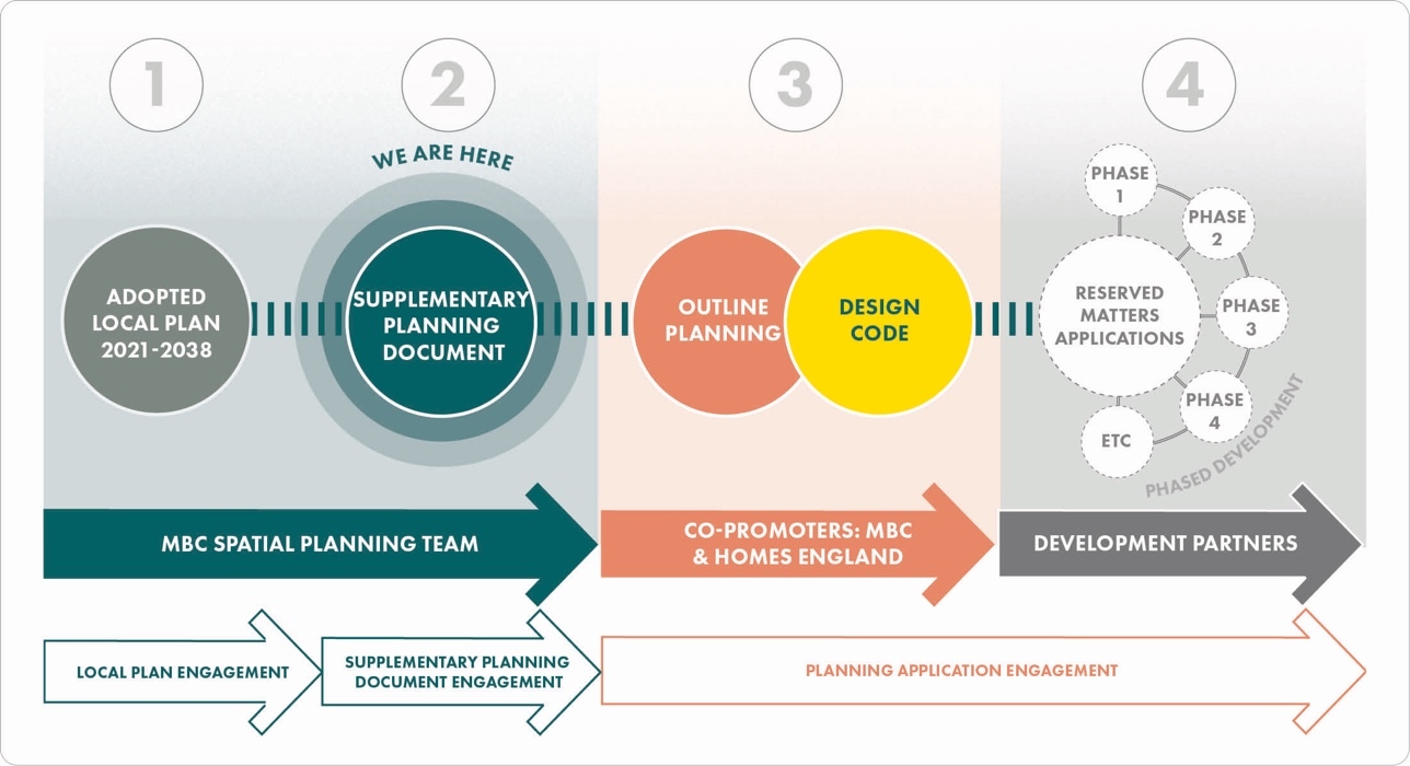
1.4.1. It is important to recognise that detailed proposals for the Garden Settlement are yet to come forward via planning applications, and the project is still at a relatively early stage in the overall planning and development process.
1.4.2. It will be the responsibility of developers and landowners to consider all relevant policies as set out in the LPR and this SPD as they prepare planning applications for the site. Such planning applications will need to be accompanied by more detailed designs, assessments and strategies.
1.4.3. Given the anticipated timescales for the overall build out of the Garden Settlement it is envisaged that detailed work to set out the design and layout of the site will come forward on a phased basis and be subject to future stages of decision making. It is currently anticipated that development proposals are likely to come forward through an Outline or Hybrid Planning Application, supported by all necessary material to enable consideration by the Council of the overall scale and parameters of appropriate and acceptable development.
1.4.4. Further information on what is required at the next stage of the process is set out at Section D of this SPD. This includes the need for design codes alongside planning applications to ensure high quality design outcomes will be achieved.
1.4.5. Following this, it is anticipated that the Council will then continue to consider more detailed proposals as they come forward, discharging requirements set by planning conditions and considering future 'reserved matters' applications which will contain the full and final details prior to construction.
1.4.6. All subsequent stages of work will be subject to appropriate levels of consultation and engagement with all key stakeholders. Ultimately, MBC will retain the key decision making role to ensure that the overall vision and objectives for the Garden Settlement will be realised.
2. Policy Context
The National Planning Policy Framework (NPPF) sets out the Government's planning policies for England and provides the framework both for plan-making and decision-making.
2.1. National Planning Policy
2.1.1. The National Planning Policy Framework (NPPF) has been subject to regular review and updating, with the latest version published in December 2024.
2.1.2. The NPPF sets out that the purpose of the planning system is to contribute to the achievement of sustainable development, which is translated into three overarching objectives – economic, social and environmental. The NPPF is supported by the companion National Planning Practice Guidance (NPPG).
2.1.3. The NPPF highlights how large- scale developments, including new settlements, can play a role in facilitating the delivery of new homes whilst recognising that developments of this scale require careful consideration of design quality, environmental protection and enhancement, and infrastructure delivery.
2.1.4. In relation to transport, Circular 01/2022 issued by the Department of Transport should be read in conjunction with the NPPF. This sets out the Government's policy in relation to the Strategic Road Network and how National Highways will engage with the planning system.
2.2. Local Planning Policy
2.2.1. The LPR is the principal document in Maidstone's statutory Development Plan. The LPR establishes the spatial strategy for the Borough to address identified local development needs including housing, employment and infrastructure. It also includes strategic and non-strategic policies across a range of topics.
2.2.2. Local Plan Policy LPRSP4(A) makes provision for a new large-scale garden settlement, the Heathlands Garden Settlement in accordance with the spatial strategy for the borough. The policy sets out the overarching land-use parameters and detailed design and development requirements for the site, which all future planning applications must comply with.
2.2.3. Maidstone's overall development plan also includes documents prepared by Kent County Council such as the most up to date Kent Minerals and Waste Local Plan.
2.3. Design Guidance
Garden City Principles
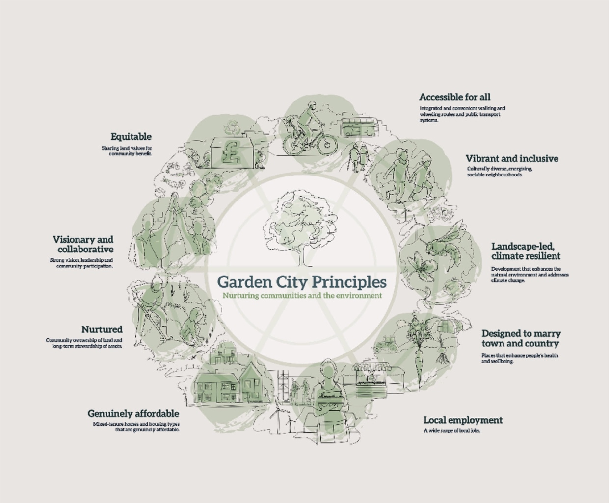
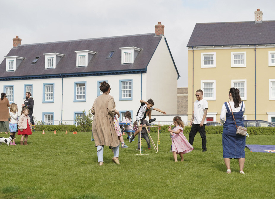
2.3.1. The concept of a 'Garden Settlement' has its roots in the 'Garden City Movement' of the early 1900s. Garden Cities represent principles of good planning, plentiful open space, and active community involvement.
2.3.2. Large scale developments built today should apply the same principles, but in a 21st Century context. The Heathlands Garden Settlement will be expected to support and provide for a modern sustainable way of living.
National Design Guide
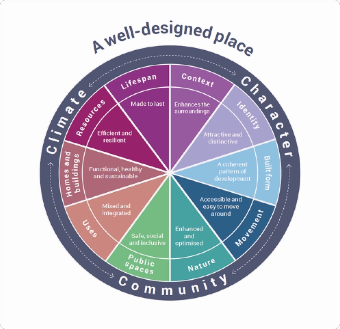
2.3.3. The National Planning Policy Framework makes clear that creating high quality buildings and places is fundamental to what the planning and development process should achieve.
2.3.4. The Government published the National Design Guide in October 2019. This guidance document outlines supports the NPPF and its focus on design quality. It sets out ten characteristics of well-designed places, which are illustrated in the diagram above.
National Model Design Code
2.3.5. The Government published the National Model Design Code in 2020. This sets out the process of preparing a design code and provides guidance on its contents to reflect the ten characteristics of well- designed places, as per the National Design Guide.
2.3.6. The Government expects Design Codes to be prepared across areas and for important developments as a key mechanism to ensure high quality outcomes.
The concept of a ‘Garden Settlement’ has its roots in the ‘Garden City Movement’ of the early 1900s. Garden Cities represent principles of good planning, plentiful open space, and active community involvement.
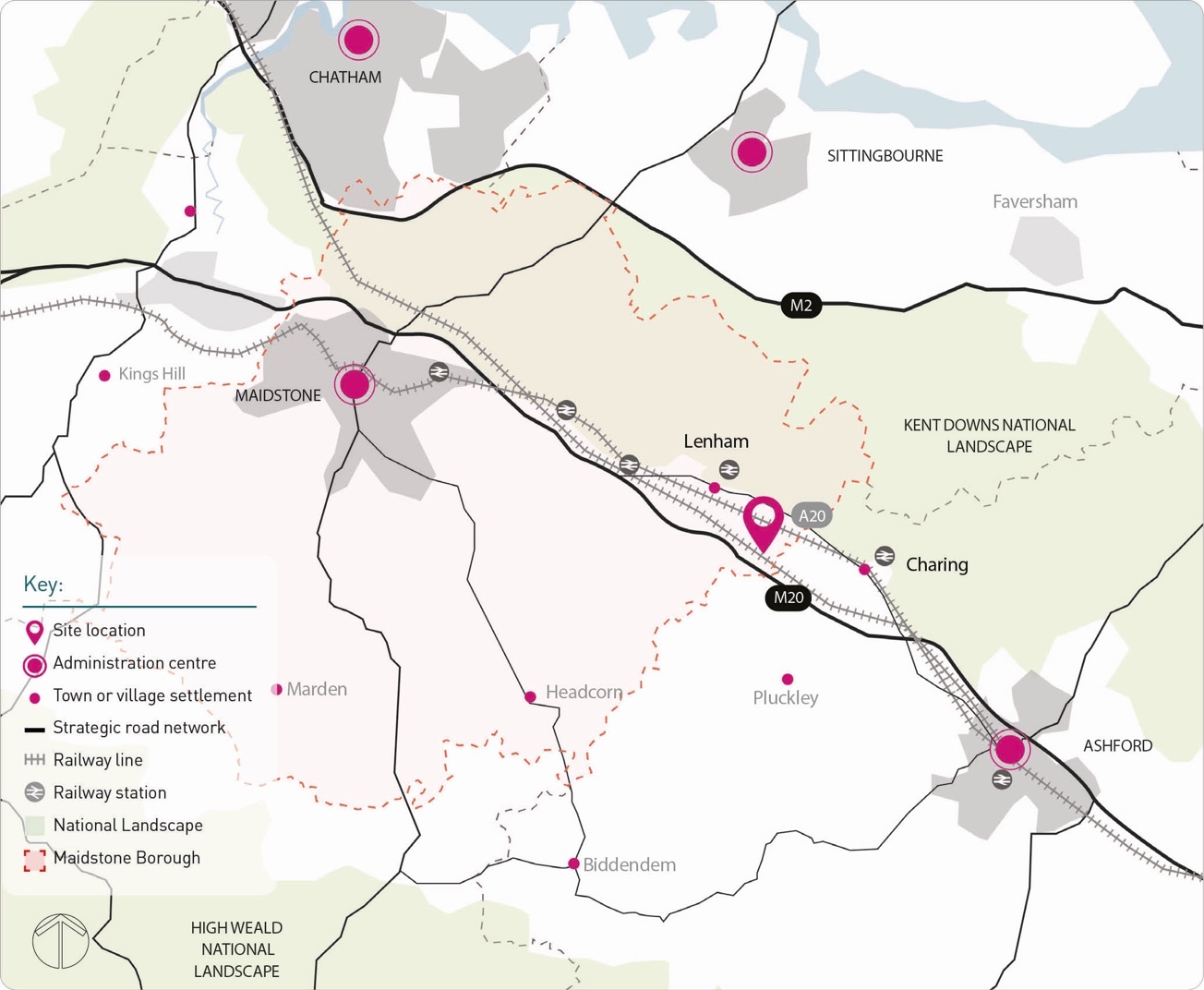
3. Site Context
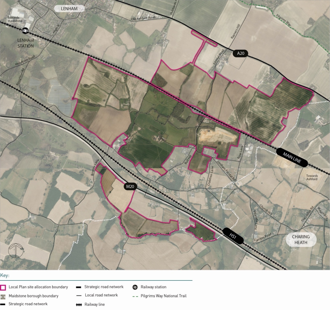
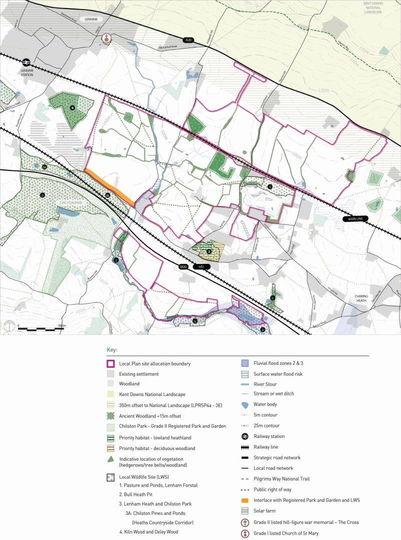
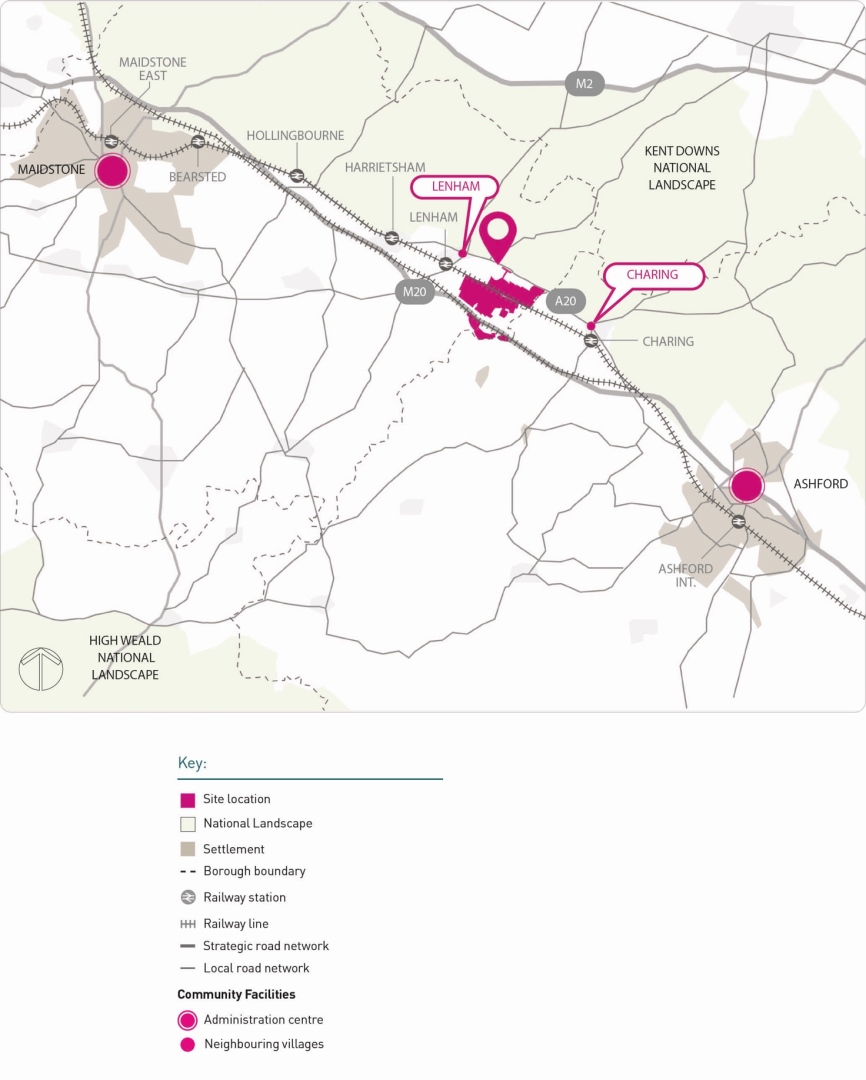
The Heathlands Garden Settlement is located on a 340 hectare site (approx.) close to the North Kent Downs National Landscape (KDNL) between the villages of Lenham and Charing.
3.1. Location Boughton Rd
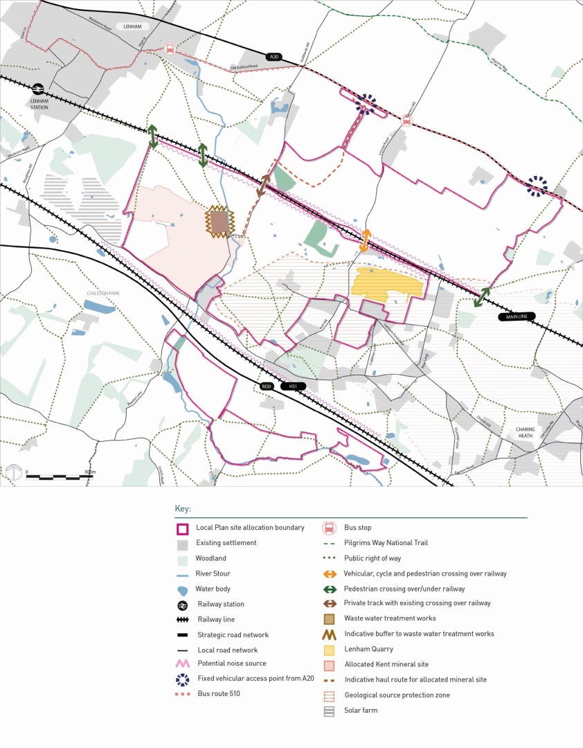
3.1.1. The site boundary immediately abuts the existing Hamlet of Lenham Heath. Its location follows the existing linear settlement pattern along the strategic road network (trunk motorway and main 'A' roads) and rail network. The urban areas of Maidstone and Ashford are located further away to the site's northwest and southeast respectively.
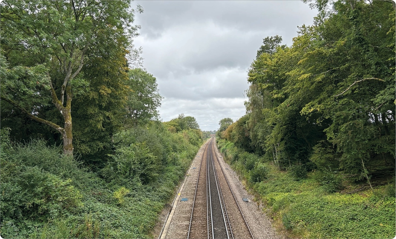
3.1.2. The east-west railway line between London and Ashford International bisects the northern and southern areas of the site, with the M20 and High Speed 1 (HS1) line set further to the south. The A20 is located immediately north of the site boundary, separated by a buffer to the Kent Downs National Landscape
3.1.3. The site includes the Great River Stour which runs north-south through the western side of the site.
3.1.4. There are a number of existing roads running through the wider site boundary serving the existing properties of Lenham Heath. The most notable of these is Forstal Road which provides an existing access onto the A20.
3.1.5. The site subject to this SPD is the land identified and allocated within the LPR and set out on the Policies Map. It focusses on the specific site area that has been allocated, but also considers the immediate surrounding areas.
3.2. Key Features and Site Characteristics
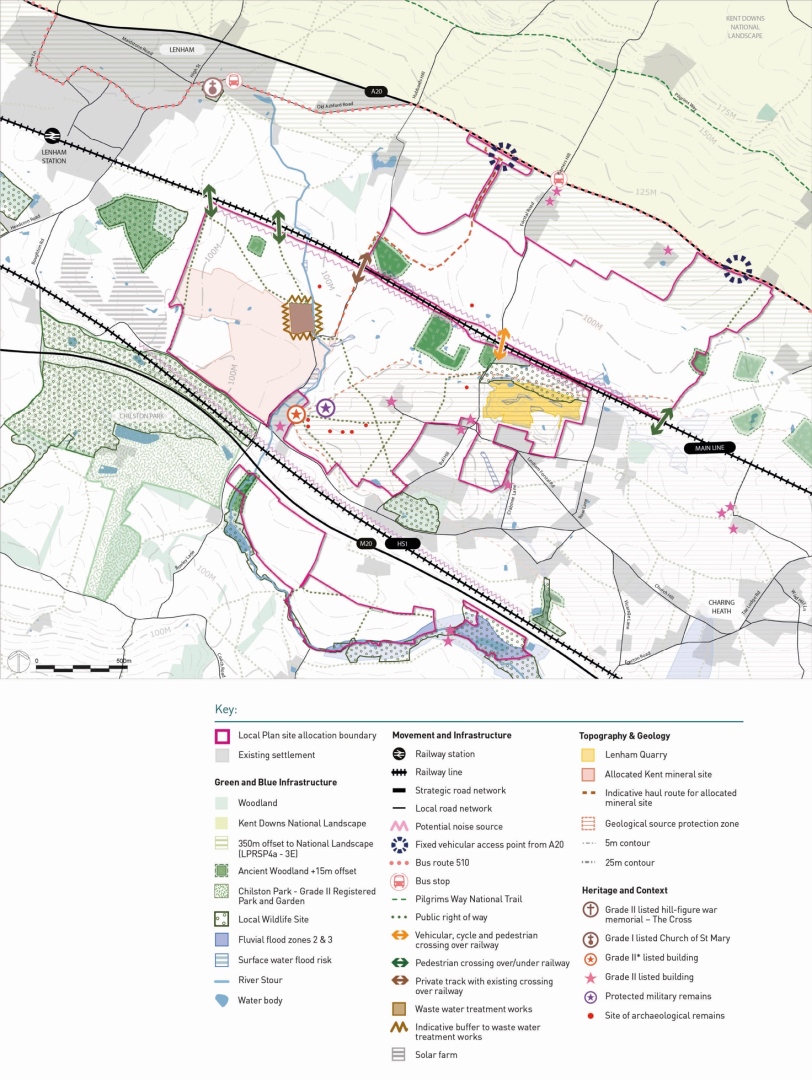
The site is characterised by gentle undulating topography with a historic wooded character which has evolved over time, as areas of woodlands have been cleared for agricultural uses.
Landscape and Topography
3.2.1. Dispersed hamlets and farmsteads sit in the landscape amongst the remaining woodland and field boundaries. The existing development pattern, mature woodland, waterways and landscape assets are distinctive characteristics of the site.
3.2.2. The topography of the site means it is reasonably well contained visually, with two natural bowls to the east and west of the site area, though there are points of higher ground visible from beyond the site's boundary.
3.2.3. Parts of the site are subject to minerals workings and restoration. Lenham Quarry is an established quarry (fully excavated and now being restored) located immediately to the south of the London to Ashford railway line to the east of Forstall Road. Chapel Farm, located in the south-west of the site boundary is an identified future quarry which is due to be excavated from 2027/28. Both quarries are to be restored so they will sit lower than their immediate surroundings.
3.2.4. The Kent Downs National Landscape, a designated National Landscape lies to the north and east of the site.
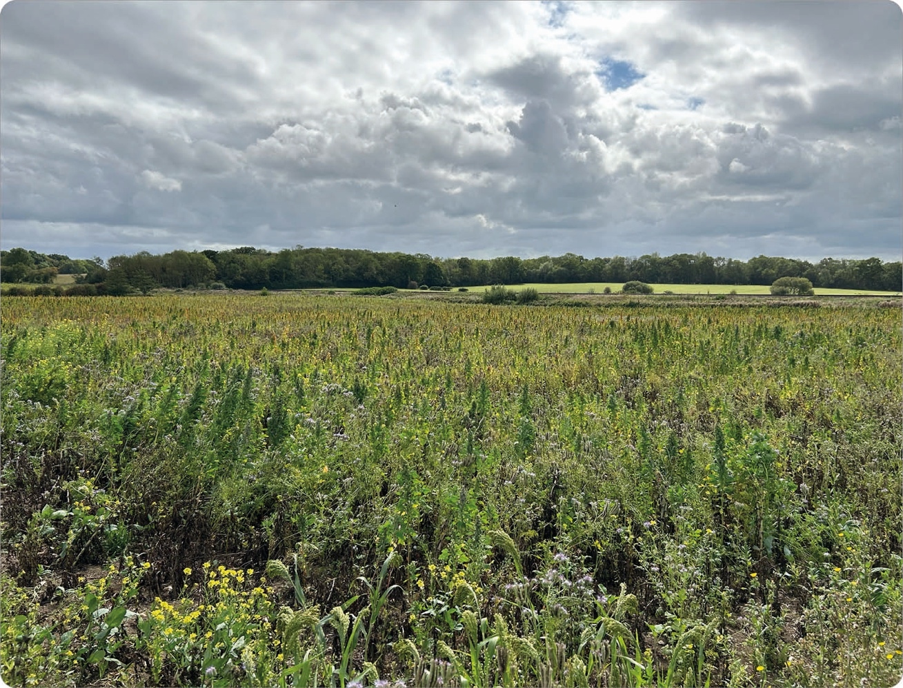
Ecology
3.2.5. The network of ecology within and around the site includes waterways, ponds, hedgerows, and trees. These ecological features form an integral part of the landscape structure for the site. They support biodiversity and natural habitats.
3.2.6. There are several areas of Ancient Woodland, other woodlands and hedgerows located within the site. A number of locally important non- statutory designated Local Wildlife Sites (LWSs) fall within 2km of the site, of which two fall within the site, Lenham Heath and Chilston Park Local Wildlife Site and the Pasture and Ponds, Lenham Forstal Local Wildlife Site. In addition, Bullheath Pit LWS is adjacent to the Site.
Heritage and Archaeology
3.2.7. The site and its wider landscape are characterised by a series of dispersed medieval and later farmsteads associated with medieval Lenham. The fields still largely respect the former historic land divisions, with various historic landscape features pre-dating 1840, and earlier, including hedgerows, ancient woodland, and trackways.
3.2.8. Built heritage assets in close proximity to the Site are: Chilston Park Registered Park & Garden, Grade II; Royston Manor, Grade II*; Mount Castle Farm, Chapel Mill, The Forstal, Forstal Cottages, New Shelve Farmhouse, Old Shelve and Crabbe Farmhouse.
3.2.9. Areas of potential archaeological importance have been identified within the site boundary.
Transport and Connectivity
3.2.10. The Garden Settlement lies to the south of the A20 in between Lenham and Charing. The M20 runs through the area, with junction 8 around 10km to the west (towards Maidstone & the M25) and junction 9 around 12km to the east (Ashford).
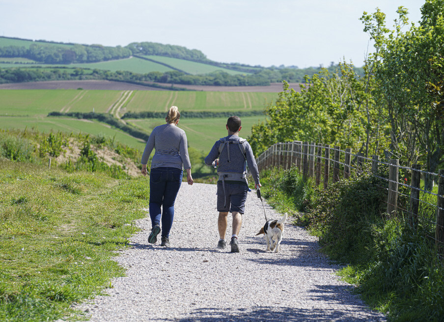
3.2.11. A network of Public Rights of Way (PRoW) traverses the site and connects to the nearby villages of Lenham and Charing and to Pilgrims Way.
3.2.12. National Route 17 of the National Cycle Network is located along the North Downs Way to the north of the Garden Settlement.
3.2.13. The main bus route in the vicinity of the site runs along the A20 between Maidstone and Ashford.
3.2.14. The proposed development is located between two railway stations - Lenham and Charing, both located on the same railway line with services between London Victoria (via Maidstone East) and Ashford International.
Flood Risk and Water Management
3.2.15. The majority of the site is located within Flood Zone 1, with low probability of flooding. Some areas in the southern part of the site are within Flood Zones 2 and 3 with medium and high probability of flooding, where ground elevations are generally lower and in close proximity to the Stour. These areas of flood risk are associated with the river Great Stour, which flows from west to east along the southern site boundary in the land to the south of the M20.
3.2.16. A wastewater treatment works (WWTW) is located within the western side of the site. Technical studies have identified that there are elevated levels of nitrogen and phosphorus being caused by the discharge of effluent from the on- site WWTW plant and surface run- off which is adversely impacting the water quality of the Stour and the Stodmarsh Lakes downstream. Any future development of Heathlands will require further consideration of nutrient loading and operational capacity at the current WWTW, including any necessary mitigation measures.
Local Services
3.2.17. The site is positioned between the main towns of Maidstone and Ashford. The villages of Lenham and Charing provide a range of local shops and services. Across the wider area, Maidstone and Ashford contain a wider range of services and facilities provision, including retail, leisure and commercial provision.
3.3. Constraints and Opportunities
3.3.1. Proposals for the site were assessed as part of the LPR process including consideration of a range of opportunities and constraints.
3.3.2. Figure 9 sets out key issues, constraints and opportunities that will need to be considered as part of the approach to delivering the Garden Settlement.
Key elements to be considered as part of the approach to delivering Heathlands Garden Settlement:
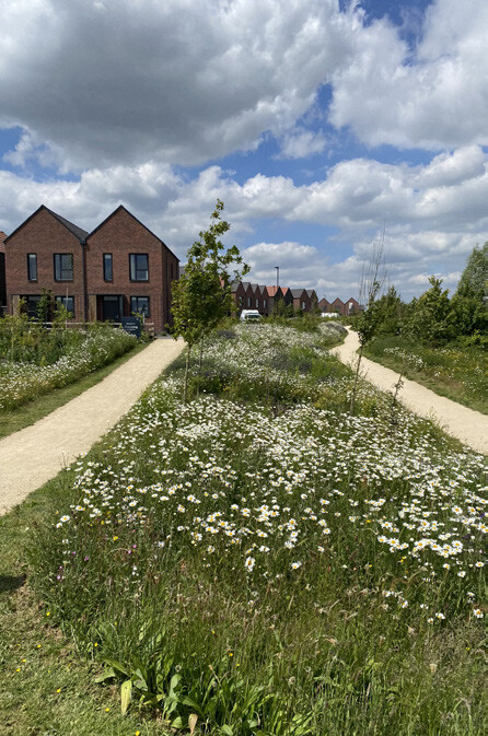
- Ensuring that a 'landscape led' approach is taken, considering the proximity to the National Landscape, existing topography, and current landscape and green infrastructure to reinforce the site's landscape character and promote biodiversity.
- Retention of existing ancient woodlands (with minimum buffers), hedgerows, mature trees and vegetation and water courses, public rights of way and ecological corridors to contribute to achieving 20% biodiversity net gain.
- Existing waterways on the site should be retained and enhanced as key features within the open space network.
- Designated and non-designated heritage assets, including historic field boundaries and stone walling, will influence the layout and character of development parcels.
- Sustainable access and movement provision will be needed including a network of pedestrian and cycle routes, enhanced bus provision, a new railway station and mobility hubs across the Garden Settlement to promote sustainable movement choices and minimise as far as possible use of the private car.
- Existing Public Right of Way routes crossing the site must be integrated into the green space network, creating safe and attractive leisure routes providing easy access to the wider countryside.
- There will be a requirement for additional and/or enhanced vehicular and pedestrian cycle bridges to create a permeable layout and adequately connect and integrate the site across key existing barriers such as the railway lines and M20.
- Existing lanes running through and beyond the site will be respected and where possible protected from additional traffic. Opportunities for traffic calming and minimising movement must be explored to make them more pedestrian and cycle friendly.
- The opportunity exists given the scale of development proposed to provide for a range of new facilities, services and employment opportunities.
- The need to accommodate either the potential expansion and improvement of the existing Waste Water Treatment Works or its relocation to a suitable part of the site.
- Requirement to provide and maintain access to minerals extraction site to the west of the central parcel while early phases of the development to the east are brought forward.
Q1: Do you agree with the principle of introducing additional planning guidance for the Heathlands Garden Settlement in the form of a Supplementary Planning Document? View representations
Q2: Do you agree that the correct key issues and elements have been identified in relation to the context of the site? View representations
Q3: Are there any issues and elements which you feel are inaccurate or missing? View representations