Lidsing Garden Community SPD
6. Placemaking Guidelines
This section provides guidance on specific parts of the emerging masterplan to guide subsequent planning applications and will be used in the decision-making process alongside the relevant policies in the Maidstone Borough Development Plan.
6.1. Introduction
6.1.1. This section is supplementary to the general principles that are set out with the framework plans section and should be read in conjunction with that section.
6.1.2. To support this section several topic papers have been produced to evidence the context and reasoning behind the decisions made. These include:
- Green & Blue Infrastructure Topic Paper.
- Housing Topic Paper.
- Design Topic Paper.
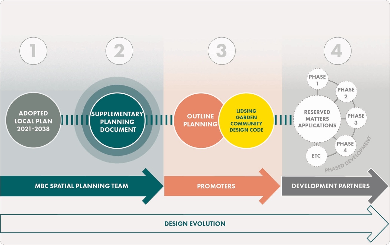
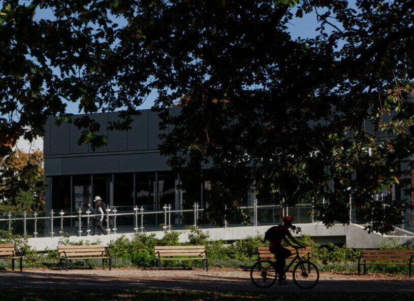
6.1.3. This section will provide general design parameters for the development that will form the basis of a future design code as required by Policy LPRSP4(B) criteria 3 (b). It is expected that this is part of the evolving design process for the site (Figure 27).
6.2. Design Code
6.2.1. As a result of the scale of the development and the design sensitivities, there is an expectation through the site allocation policy that there is a design code to follow as part of the planning application process for the site (see Figure 27).
6.2.2. Design codes are important because they provide can set out a framework for creating healthy, safe, green, environmentally responsive, sustainable and distinctive places, with a consistent and high-quality standard of design. This can provide greater certainty for communities about the design of development and bring conversations about design to early stages of the planning process rather than the end.
6.2.3. Given the scale and context of the Lidsing Garden Community, and the long-term nature of its delivery, the Council expect that a comprehensive approach will need to be secured via the preparation and approval of a site wide 'Strategic Design Code'. Further neighbourhood specific masterplans and design codes may also be subsequently required for relevant phases of development.
6.2.4. The Councils will expect the Design Code to establish a high design quality approach to development across the Garden Community as a whole, and within each of the neighbourhoods. The following design principles should be used as a basis for any subsequent design code.
Key Principles/Guidance:
Design Code
Overview
- It is expected that the Design Code shall follow the outline planning application and prior to any reserved matters applications. The Design Codes shall be broadly in accordance with the Lidsing Garden Community SPD.
- Design Codes must set out clear design parameters to help the Council and communities understand what good quality design looks like and how it will be achieved.
- Design Codes must cover the aspects set out within the 10 characteristics of good design as per the National Design Guide and guidance in the National Model Design Code and set out in Appendix C of this document.
- Codes must be simple, concise and specific and include visual and numerical information rather than detailed policy wording.
- Design Codes must come forward through a collaborative process between the promoters and the Council and should have regard to the LPR and this SPD.
- The preparation of Masterplans and Design Codes must be informed by the appropriate design review and assessment frameworks such as the National Design Guide, National Model Design Code, Building for a Healthy Life and Building with Nature, or similar.
Q8: Do you agree with the principles & guidance for "Design Code"? View representations
Q9 Please set out any changes that you think should be made to the principles & guidance for "Design Code". View representations
6.3. Heritage
6.3.1. The National Planning Policy Framework places a strong emphasis on the role of heritage in contributing to sustainable development. It states that heritage assets are an irreplaceable resource and should be conserved in a manner appropriate to their significance, so that they can be enjoyed for their contribution to the quality of life of existing and future generations. Maidstone Local Plan Review Policy LPRSP14(B) Historic Environment gives effect to the NPPF and sets out the relevant strategic policy for Maidstone.
Heritage Impact Assessment
6.3.2. Policy LPRSP4(B) criteria 7(c) outlines that any applications need to respond to the heritage of the location and that this should be done via a heritage impact assessment. This section will provide context as to the heritage of the area and then provide guidance as to what should be within any future heritage impact assessment.
6.3.3. Whilst there are no designated assets within the site boundary there is the potential for some to be found. The site allocation does not have any impact on the following heritage designations: World Heritage Sites, Scheduled Ancient Monuments, Registered battlefields, Conservation Areas or Registered Parks and Gardens. There are listed buildings present, but these are not within the site boundary. It is noted that the site is within an Archaeological Notification Area (ANA) and therefore has the potential to include archaeological evidence and remains.

6.3.4. A desk-based assessment of heritage has been undertaken and this concluded that the site has been in agricultural usage since medieval times. However, there is still potential for archaeological evidence due to the limited fieldwork undertaken within the area. As such this alongside the historic landscape should be considered as the site progresses through the planning stages.
Military Balloon Installation
6.3.5. Policy LPRSP4(B) criteria 7(f) explains that the development should respond to the special historic environment; and an element of this is the military balloon installation located to the west of the site, see Figure 28. Some archaeological work has been previously undertaken that has identified the potential of a military balloon installation on the site. The event record EKE14761 relates to an Archaeological survey of mineral extraction sites around the Thames Estuary landscape, encompassing much of the study area, including the study site. A former extraction pit within the study site has been researched for its use as a Royal Engineers Balloon pit (EKE20276).
Key Principles/Guidance:
Heritage
Heritage Impact Assessment
- Development proposals must be informed by an understanding of the significance of the listed buildings and their setting. Proposals for development should assess what impact they might have upon other heritage assets in the vicinity of the Garden Community and demonstrate how the appropriate conservation or enhancement has been addressed in the design process. This can be achieved through a heritage impact assessment that considers the following:
- The impact of the development on the setting on Abbotts Court Farm and other listed buildings in the vicinity.
- Historic landscape value.
Military Balloon Installation
- Development proposals must be informed by an understanding of the significance the Military Balloon Installation and as such:
- A statement of significance and a desk- based survey should be submitted with the application.
- Any subsequent planning application needs to ascertain the significance of any archaeology on the site to enable this to inform the masterplan for a planning application. As such the following is needed:
- Trial trenching to be undertaken following discussion with Kent County Council, Maidstone Borough Council and Historic England.
Local Plan Review Policy: LPRSP4(B),LPRSP10(A)
Q10: Do you agree with the principles & guidance for "Heritage"? View representations
Q11: Please set out any changes that you think should be made to the principles & guidance for "Heritage". View representations
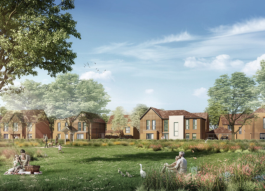
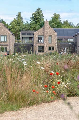
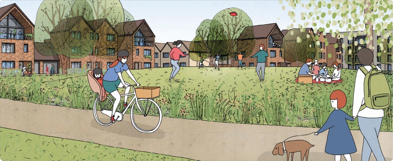
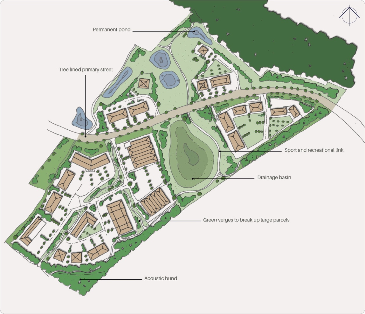
6.4.1. Lidsing Garden Community will be landscape-led and provide a network of multifunctional green spaces, including parks and amenity areas, community growing areas, hedgerows and other green links. The network of integrated green spaces and green corridors will link with the open countryside beyond the development as per Policy LPRSP4(b) criteria 3(h) (iii).
6.4.2. A Landscape Framework Plan and Topic Paper has been produced to support this SPD and to identify landscape and visual constraints and opportunities on the site. The development must integrate into its immediate and wider context as sensitively as possible whilst retaining the key characteristics of the site in a landscape framework based on the pattern of woodlands and hedgerows found within the site.
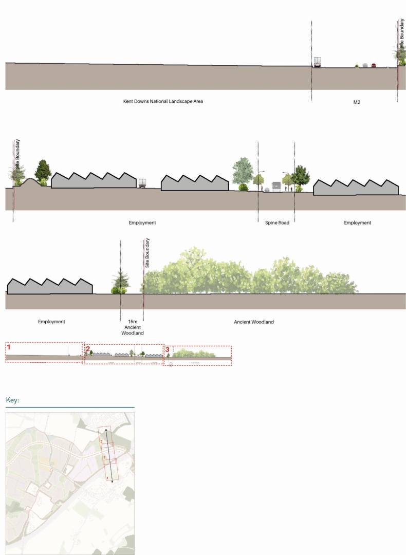
6.4.3. A sensitive transition between the development and the Kent Downs National Landscape must be provided. Mitigation will be carried out by generous appropriate planting, a minimum 15m buffer zone and appropriate use of scale and form of adjacent buildings.
Relationship with the Kent Downs National Landscape
6.4.4. There are two main areas that need to be focused on with regards to the Kent Downs National Landscape: the area within the Kent Downs National Landscape south of the M2 motorway and the area adjacent to it to the north of the M2.
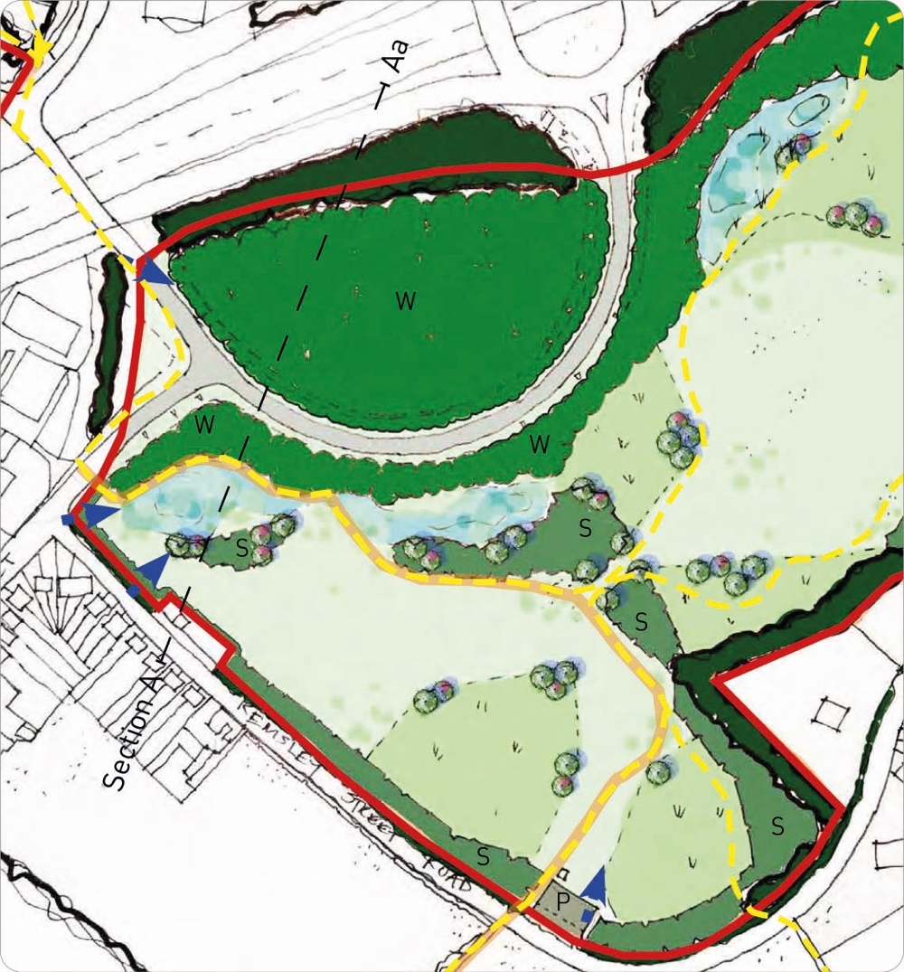
6.4.5. The area to the south of the M2 is broadly to be used as open space following the principles of design laid out in Figure 29 below.

Key Principles/Guidance:
Landscape Aa
Overall, the development will follow these landscape principles:
- Existing ancient woodlands will be provided with a 15-metre landscape buffer from development as a minimum and a 30-metre landscape buffer in sensitive locations. This is to be informed by a tree survey to BS5837 submitted as part of a planning application.
- Existing trees, woodlands, hedgerows, waterbodies and water courses should be retained and enhanced wherever possible.
Relationship with the Kent Downs National Landscape Section A
- Landscape buffers shall be provided to the major transport corridors of the M2 and to the Kent Downs National Landscape to the south. The form of planting and landscaping shall be informed by noise surveys and discussions with the Kent Downs National Landscape and adhere to the following:
- Prioritise structural planting to the south along the boundary with the M2 motorway using species of trees that create large crowns such as oak or beech.
- Allow opportunities for community of access.
- Building design should be diverse in order to break up the massing along this boundary.
- The key views into and from the site identified in the constraints plan shall be protected.
Local Plan Review Policy: LPRSP4(B), LPRSP14(A), LPRSP9, LPRSP15, LPRQD1, LPRQD4
Q12: Do you agree with the principles & guidance for "Landscape"? View representations
Q13: Please set out any changes that you think should be made to the principles & guidance for "Landscape". View representations
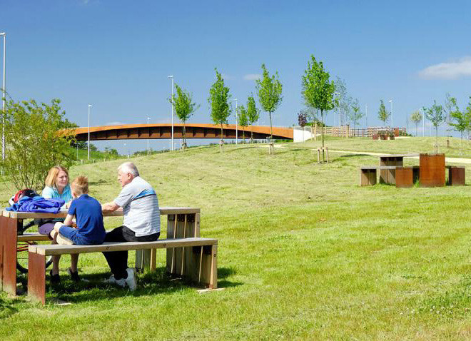
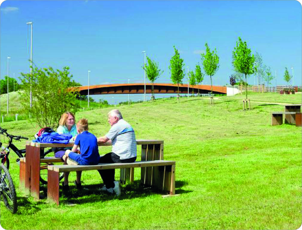
6.5. Open Space
Amenity, Play, Sports, Allotments & Natural/Semi-Natural
6.5.1. As previously outlined Policy LPRSP4(B) criteria 5 (d) sets out the minimum open space requirements. These are set as the following:
- 3.33 hectares amenity green space.
- 1.19 hectares of play space.
- 7.6 hectares of sports provision.
- 0.95 hectares of allotments.
- 31 hectares of natural/semi natural open space.
6.5.2. In line with the Maidstone Borough Council Parks & Open Spaces 10 Year Strategic Plan and playing pitches strategy (November 2020). The Council has identified gaps in the provision of certain types of open spaces and their location and the information has informed this SPD guidance section below.
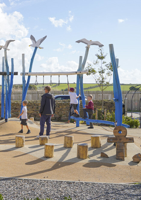
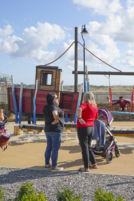
6.5.3. Play spaces refer to Local Areas of Play, Neighbourhood Areas of Play and are important hubs of community activity and for children to enjoy outdoor activities. They should be located across the site. An indicative open space framework is set out in Figure 30.
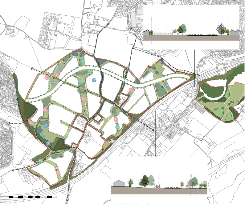
The open space will generally be consolidated to the edges of the site and deliver the following principles according to the respective typology.
Amenity Green Space
- A village green be located in the centre of the development within the new local centre.
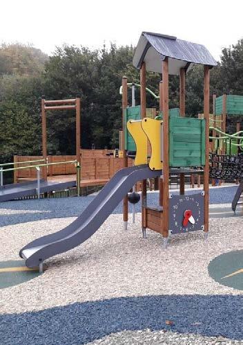
Play Spaces
- Play facilities must be designed to meet the needs of children and youth of different age groups and abilities.
- Locally Equipped Area of Play (LEAP) must be at least 400m2, no closer than 10m or further than 400m from any home.
- Neighbourhood Equipped Area of Play (NEAP) must be at least 1000m2, no closer than 30m or further than 1000m from any home.
Sports Provision
- Sports provision is to be located to the periphery of the site to enable its use by existing communities in Medway and Maidstone Boroughs.
- In line with identified need in the Maidstone Playing Pitch Strategy or its successor documents sports pitch provision should focus on the delivery of the following:
- 3G football pitch.
- Grass rugby (union and league) pitches.
Allotments
- Allotments should be accessibly located across the site.
Natural and Semi-Natural Open Space
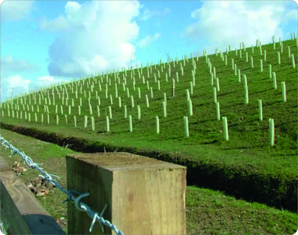
- To greater benefit the ecological habitats and enhance ecological connectivity this area should be spatially located around existing natural and semi-natural open spaces and consolidated to the eastern and western fringes of the site. Reference should be made to the emerging Local Nature Recovery Strategy for connectivity and the biodiversity net gain statutory metric.
- Additional new woodlands created across the site should be made up of appropriate native species.
Phasing
- Policy LPRSP4(b) of the Maidstone Local Plan Review sets out that at phases 1, 2 and 3 of the development open space should be delivered as requisite to the residential development.


Land South of the M2 Junction 4
- The land to the south of the M2 junction 4 is to follow several key principles:
- Land to be used for highway improvement works is to be screened by trees.
- The remaining land is to be accessible by the community, especially walkable from Bredhurst Village and maintained as open space.
- Respect the setting of listed buildings within the vicinity.
Capstone Valley
- Key views along the valley as identified are to be maintained as development comes forward.
- Access from the development to the Capstone Valley shall be provided in two ways:
- via active travel (walking and wheeling) to be provided from the site towards the Capstone Country Park.
- Wildlife connections as identified in the Green and Blue Infrastructure Framework Plan.
Medway Edge
- Overall, the development should respect the sites position adjacent to Medway Council area and this should be done in the following way:
- The design to acknowledge any permitted development and emerging allocations not already built and reflect how it can best integrate with it to avoid insular estates being formed.
- Provide for wildlife links to the Medway area.
Green Bridge
- A green bridge connection shall be developed over the M2 motorway connecting the site to the Kent Downs National Landscape:
- Specific consideration should be given to using either the existing proposed M2 Junction 4 improvement works or Forge Lane as potential locations for this green bridge connection and further detail should be provided as part of the subsequent planning application process in regard to design and the suitability of location.
- The green bridge connection work should involve the Kent Downs National Landscape, Local Highways Authority and National Highways.
- The green bridge connection design should refer to best practice guidance from the Natural England Literature Review 2015 and the Natural England via Landscape Institute Technical Guidance Note 09/15 December 2015.
- The green bridge proposal should include vegetation and provide a wildlife function and connection, including a wildlife corridor connecting each side of the M2 to facilitate connections between the Kent Downs and the Capstone Valley and details should be outlined in a subsequent planning application.
Local Plan Review Policy: LPRSP4(B), LPRSP14(A), LPRSP9, LPRSP15, LPRQD1, LPRQD4
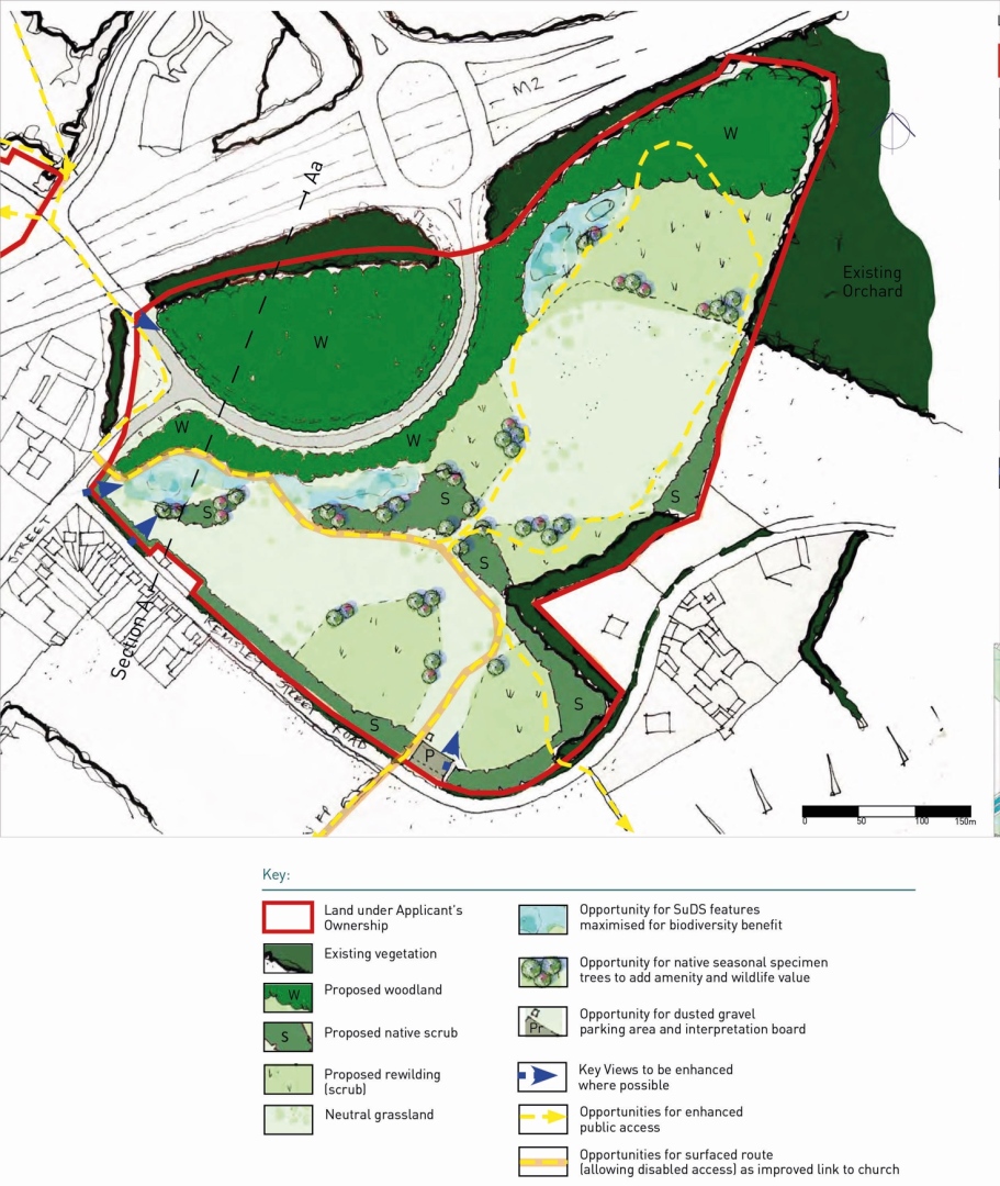
Land South of M2 Junction 4
6.5.4. An indicative Open Landscape Ecological Management Plan (Figure 31) prepared by Kent Wildlife Trust demonstrates that the land southof the M2 can be appropriately managed to provide a biodiverse area, to be secured under a longer- term management regime. The creation of a publicly accessible circular route in this area will appropriately open up this part of the National Landscape for low levels of recreational use which will reduce recreational pressure on the Kent Downs National Landscape.
Capstone Valley
6.5.5. The Lidsing Garden Community sits at the end of the Capstone Valley, part of a wider Capstone Valley landscape area as identified by the Maidstone Landscape Character Assessment (2013) which also contains important ecological assets. As such the SPD seeks to ensure that the development works with these features, especially the Capstone Valley Country Park & Darland Banks to the north. These features also have an important ecological role and therefore the SPD also seeks to ensure enhanced ecological connections from the Kent Downs into these key ecological assets, within the Capstone Valley.


Medway Edge
6.5.6. The site lies on the border with Medway Council. The Boundary with regards to a large proportion of the site is artificial and does not follow any geographical feature. However, development of the Garden community needs to respect its proximity to the Medway Council area. It should acknowledge the wider strategic growth in the Lidsing and Capstone area, and contribute positively to sustainable development, that achieves connectivity for nature and people, and provides for the effective delivery of infrastructure that meets the communities' needs. In particular Transport is a key cross border matter to be addressed.
Green Bridge
6.5.7. Criteria 3(h)(iii) of Policy LPRSP4(b) specifies the need for a green bridge connection across the M2 motorway. Green Bridges can take many forms as demonstrated by guidance from the Natural England Literature Review 2015 and the Natural England via Landscape Institute Technical Guidance Note 09/15 December 2015. The definition boils down to the following: 'an artificial structure over road or rail infrastructure which is either vegetated or provides some wildlife function'. It can take the form of a modified bridge or new structure and be used by a range of modes or none. The concept of a green bridge for the site was brought out at the Local Plan Review 2021-2038 examination to link the landscape across the M2 motorway.
Q14: Do you agree with the principles & guidance for "Open Space"? View representations
Q15: Please set out any changes that you think should be made to the principles & guidance for "Open Space". View representations
6.6. Movement & Connectivity
6.6.1. A core element of the vision for the Lidsing Garden Community is to improve connectivity to the wider area through the development of this location. One of the objectives develops this, setting out how the development is to improve and be sustainably connected internally and externally.
6.6.2. In order to ensure that residents, workers and visitors to the Garden Community can make more sustainable transport choices, planning applications should demonstrate how the following measures will be provided:
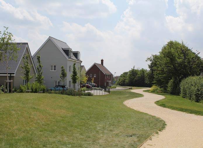
- Attractive, inclusive and safe walking and cycling infrastructure;
- A network of walking and cycling routes including footpaths, trails and nature connections should be designed in linking all areas on the site and connections to existing communities external to the site;
- A high quality public transport option.

Active Travel
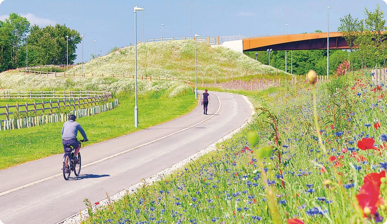
6.6.3. Active travel should be an integral part of the garden community. It is one of the garden community's principles from the Town & Country Planning Association. This is supported through national policy that seeks to promote active travel and widen transport choice. Local policy supports this approach, supporting modal shift and active travel as seen in relevant LPR policies.
6.6.4. The site has the opportunity to enhance the existing network to help provide for Active Travel.
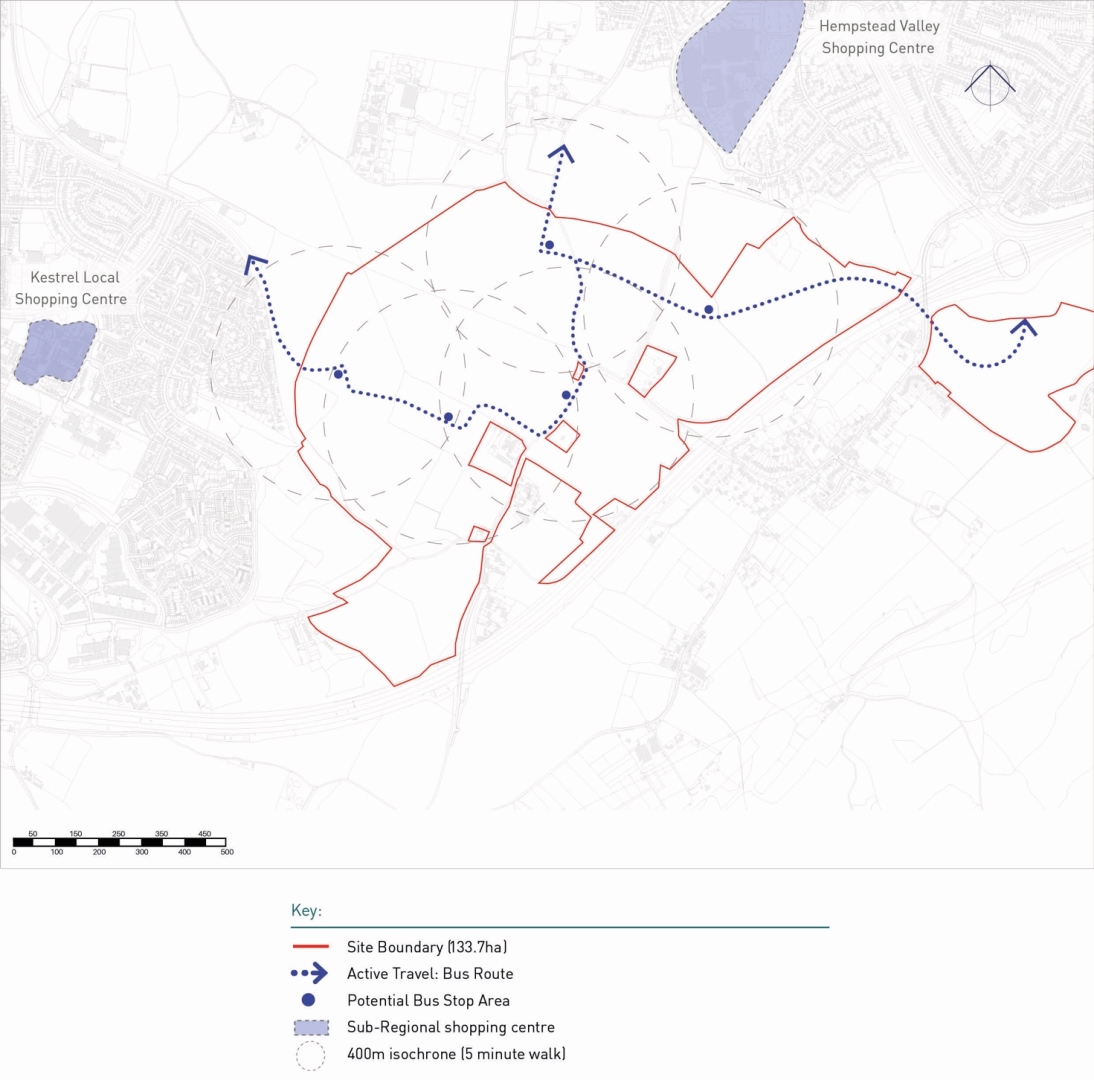
Public Transport
6.6.5. Public transport is to be a priority for the development. Both Policy LPRSP4(b) and the Maidstone Infrastructure Delivery Plan require there to be bus services through the site.
6.6.6. The Primary Street will be a bus route, functioning as a major sustainable movement corridor. In line with Manual for Streets guidance, movement of buses will be prioritised over private vehicles.
6.6.7. The bus route must support the provision of a regular (half hourly) and frequent service connecting the site to Medway and Maidstone. A phased strategy for the bus route must be developed to ensure that early phases of the development have access to public transport connections prior to the completion of the garden community.
Street Design
6.6.8. As indicated within the Movement and Connectivity Framework Plan, the site will have both primary, secondary and tertiary streets.
6.6.9. The primary street will be the east– west connection across the site from North Dane Way to the M2 Junction 4. This will be designed to be multi modal as illustrated in Figure 33. The design of this route should support linkages to ecological assets in particular along the green infrastructure network.
6.6.10. A proposed example of how the east– west link road could be designed is illustrated below. The east–west link road will be designed to allow for connectivity across it to allow access from the north to the south of the site via active travel methods.
6.6.11. All street design should incorporate active and sustainable travel which is a key priority for the Council as per the objectives of the Maidstone Walking and Cycling Strategy (2011-2031) and Maidstone Integrated Transport Strategy (2011-2031).
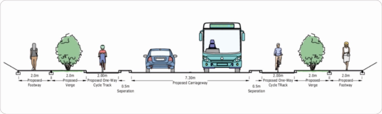
6.6.12. Secondary streets across the site are to provide access to the housing and residential areas and will not be used as through routes. However, they are still to provide routes for active travel connections. See Figure 33 for example of potential layout.
6.6.13. Pavements and cycle paths should dominate the appearance of roads rather than cars, with attractive landscaping and easy to use crossings and junctions.
6.6.14. Vehicles should not create a hostile environment for other road users, and whilst streets should allow for the free flow of traffic, planning applications should demonstrate how they will put pedestrians, cyclists, and those with mobility impairment first.

Active Travel
- Proposals should ensure a well-connected network of pedestrian and cycle routes around the site with priority over traffic as a key principle using continuous pavements on side roads as per the Active Travel England Guidance.
- The development should incorporate provision for east-west links between Lordswood and Hempstead and south to Bredhurst Village by walking and cycling.
- Public rights of way in the site should be protected and retained, but also enhanced to become active travel corridors that are integrated with the development, well overlooked and safe to promote usage.
- Pedestrian and cycle paths should be safe off-road routes that are direct to destination following desire lines and designed to the LTN1/20 guidance or successor document standards.
- Cycle parking should be supplied at destination points such as the employment area, local centre, medical facility and primary school and this should be near to entrances and safe and secure.
Public Transport
- The garden community must be directly connected to the wider public transport network and key outer destinations with frequent and reliable services.
- Sustainable travel behaviours must be established from the outset through the facilitation of quality services and discounted/ free travel offers for residents.
- A flexibly designed bus route network must be planned into the development to provide access to destinations within and around the site, and to all key destinations outside the site.
- The bus route network on the site must allow for both fixed bus routes, and shared transport including Demand Responsive Transit.
- Bus stops should have real-time travel information and be safe comfortable spaces for those waiting.
- A serviced bus route (including shelters) must be in place from phase 1 and expand with the development phases to ultimately serve all three phases of the development, including options to expand and to create future eastward connections.
- The entire bus network must be accessible and inclusive. This includes the design of level access to the buses.
- Bus stops must be provided within 400m walking distance radius of all homes.
- Bus stops must be sheltered, accessible and attractive, clearly visible and overlooked and well-lit at night.
Street Design
- The streets within the site require a legible hierarchy of road types which are suited to the routes, vehicle types and places they serve.
- All streets should benefit from passive surveillance, landscaping, and appropriate provision for users of all modes.
- The materiality, street furniture and landscaping should be designed to provide consistent dimensions in accordance with the street hierarchy but may vary according to the character of each neighbourhood. The primary street should be designed to support ecological linkages across the site including allowing for wildlife movement.
- All streets must be designed to suit emergency access requirements and appropriate servicing.
Local Plan Review Policy: LPRSP4(B)(6d), LPRSP10(A), LPRSP10(A), LPRTRA2
Q16: Do you agree with the principles & guidance for "Movement & Connectivity"? View representations
Q17: Please set out any changes that you think should be made to the principles & guidance for "Movement & Connectivity". View representations
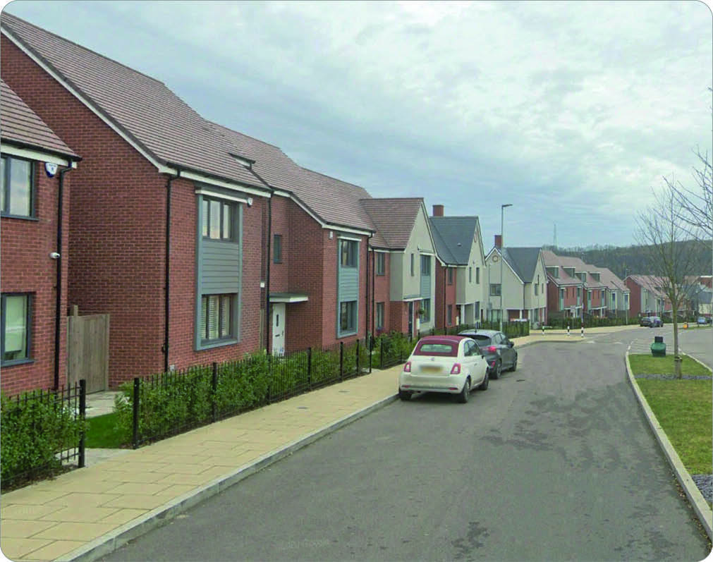
6.7. Placemaking, Density & Character
6.7.1. Design is an important feature of how a place functions and can influence how residents use and interact with the development.
Density
6.7.2. National Policy directs plans to make the efficient use of land when considering densities for development. This is supported by local planning policy which seeks garden communities to have a net density of 40 dwellings per hectare overall. The site Policy LPRSP4(b) criteria 3(h) (viii) builds on the local general policy and requires a range of density across the site, with a general reduction toward the M2 motorway in recognition of the Kent Downs National Landscape.
6.7.3. Placemaking is at the heart of the Lidsing Framework Plan. Clearly defined character areas relate to green and neighbourhood nodes and give clues for the types of homes that will be built. Each parcel will have a variety of densities which will be further defined at the planning application stage. However, in broad terms, the following range has been created:
- low density areas 20-25 dpHa;
- medium density areas 30-35 dpHa;
- high density areas 40-45 dpHa.
6.7.4. The lowest density should be towards the edges of the site to reflect the existing protected landscapes and ecology.
6.7.5. High density areas are focused around the local centre where flats can be located above retail units and homes for older people can take advantage of local facilities. This is also a good location for affordable flats or for residents who do not own their own car as the bus route will serve this area.
Heights
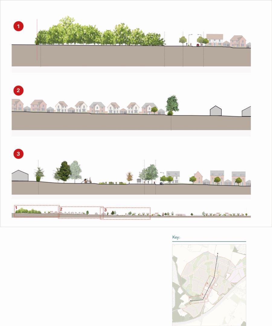
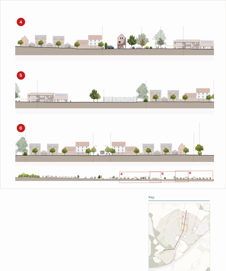
6.7.6. Building heights are important within the Lidsing Garden Community due to its location adjacent to the Kent Downs National Landscape and proximity to other landscape assets such as Ancient Woodland and the Capstone Valley. It is important for the built environment not to dominate the landscape and as such respect natural features. Indicative cross sections are laid out in Figure 34 and 35.
Key Principles/Guidance:
Placemaking
Density
- Development must be delivered at densities that reduce towards the M2 motorway.
- Higher densities should be located near to the local centre to reduce dependence on private car use and reflect its mixed-use nature.
- Appropriately designed higher density development can feature along the new spine road where they will create a buffer between the road and the rest of the site.
- Lower densities are required at the south of the development near to the Kent Downs National Landscape, to respect the landscape character.
- Lower densities are also to be required near to existing landscape features such as Ancient Woodlands or identified habitats such as identified in the ecology site context plan.
- Indicative housing types shall be provided to illustrate the densities envisaged and further detail provided in the subsequent design code.
Heights
- The tallest buildings must be located in the village centre and neighbourhood hubs to create a set of legible and well-designed focal points.
- The heights of buildings must also respect key views through the site and its topography, with the massing of buildings designed to frame key views.
- Heights adjacent to the areas of Ancient Woodland would need to be respectful of these landscape features and not dominate them.
- Transitions between different heights must be natural and subtle, particularly near open spaces and heritage assets.
- The ridge heights of the buildings in the employment zone must not exceed 9m.
Local Plan Review Policy: LPRSP4(B), LPRHOU5, LPRSP4(B), LPRSP14(c), LPRSP15 (5 )
Q18: Do you agree with the principles & guidance for "Placemaking, Density & Character"? View representations
Q19: Please set out any changes that you think should be made to the principles & guidance for "Placemaking, Density & Character". View representations
6.8. Character Areas
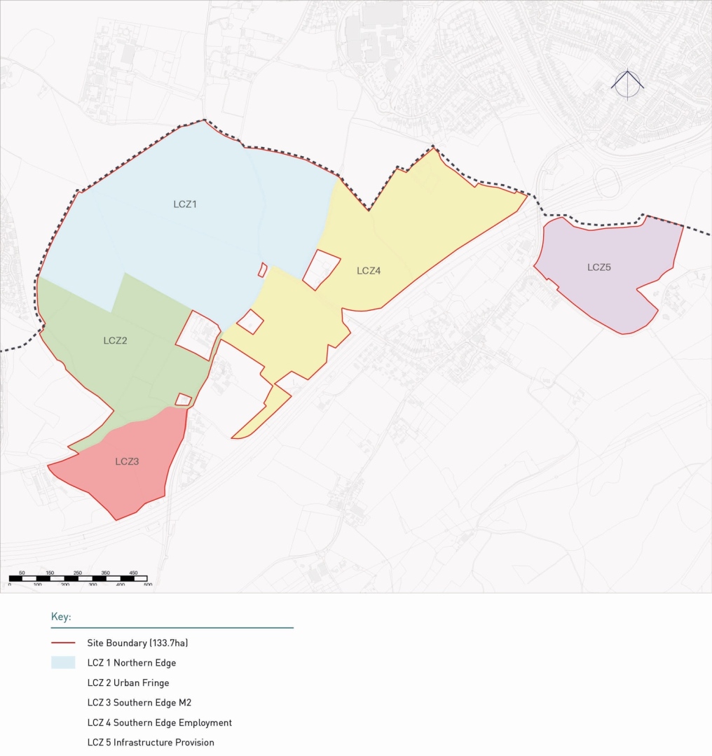
6.8.1. Through the development of the evidence base of the Local Plan Review to inform the Lidsing Vision Masterplan Framework several neighbourhoods were identified. These emerged from the landscape character areas and phasing of the development. A total of 5 neighbourhoods emerged including:
-
LCZ 1 – Northern Edge
-
LCZ 2 – Urban Fringe
-
LCZ 3 – Southern Edge M2
-
LCZ 4 – Southern Edge Employment
-
LCZ 5 – Infrastructure Provision
6.8.2. The character areas outlined should form the basis of the design code to follow.
The design code would be expected to adopt a character area approach as set out below.
LCZ 1 – Northern Edge
The following principles should be followed in LCZ1:
- Link to a shared civic space, to form part of the central Community Hub.
- Opportunity for a Village Green.
- Foot and cycle paths providing access through the development, converging at the local centre and the new village green.
- Denser, higher housing will frame the civic space, and provide passive surveillance.
- Lower density housing on the edges of the development to create a landscape- led transition between the proposed development and the surrounding area.
- Private drives would likely serve the dwellings on the edge of the development.
- Houses with frontages facing areas of open space to provide passive surveillance to the public open space.
LCZ 2 – Urban Fringe
The following principles should be followed in LCZ2:
- Mix of low and medium density housing with strong frontages onto open spaces and the east-west link, providing overlooking and an attractive backdrop.
- Opportunity to introduce other uses to complement existing neighbouring employment areas and provide a local productive hub.
- Be respectful of the Ancient Woodland and ecological habitats maintaining buffers and green corridor connections.
LCZ 3 – Southern Edge M2
The following principles should be followed in LCZ3:
- Noise attenuation measures will need to be incorporated along the southern boundary with the M2.
- New landscape planting along this edge to provide visual screening from the M2 as well as providing any required screening of development from the Kent Downs National Landscape to conserve and enhance this landscape.
- Continuous diverse building frontages to help reduce noise impacts from the M2.
LCZ 4 – Southern Edge Employment
The following principles should be followed in LCZ4:
- Noise attenuation measures will need to be incorporated along the southern boundary with the M2.
- New landscape planting along this edge to provide visual screening from the M2 as well as providing any required screening of development from the Kent Downs National Landscape to conserve and enhance this landscape.
- Continuous diverse building frontages to help reduce noise impacts from the M2 plus the requirements set out in the employment section of the SPD.
- Maintain suitable buffers to the woodland areas to the east of the site.
LCZ 5 – Infrastructure Provision
- Please see opens space section of the SPD entitled 'Land South of M2 Junction 4' for details.
Local Plan Review Policy: LPRSP4(B), LPRHOU5, LPRSP4(B), LPRSP14(c), LPRSP15 (5 )
Q20: Do you agree with the principles & guidance for "Character Areas"? View representations
Q21: Please set out any changes that you think should be made to the principles & guidance for "Character Areas". View representations
6.9. Housing
Housing Mix
6.9.1. Lidsing Garden Community will contain a mix of housing to respond to different ages and incomes and addressing the needs of the Borough. A mix of housing tenures, types and sizes should be provided across the site including terraces, detached and semi- detached homes, mews dwellings, townhouses, maisonettes and apartments.
6.9.2. Local Plan policy requires that the mix should be informed by the most up to date Strategic Housing Market Assessment together with relevant and recent information as well as considering market factors and the location and characteristics that exist across the site.
6.9.3. In accordance with policy LPRSP10(A)6, the development will be expected to provide an element of supported or specialist housing to help contribute towards meeting the needs of older persons and households with specific needs.
6.9.4. Whilst the majority of homes are anticipated to be delivered by national housebuilders, the Garden Community should also include areas for local builders and other small and medium sized developers. This can help to deliver a diverse range of housing types and at increased delivery rates. The Council recognises that the use of local SME builders can also deliver many local social and economic outcomes, including contributing to local training and job creation.
6.9.5. A Garden Community should seek to be a mixed community and as such through the Housing Topic Paper has investigated whether the need exists for the residential care. The paper concluded that there is a potential need for residential care within the Lidsing Garden Community as there is a gap in provision in this part of Maidstone Borough.
Self-Build & Custom Build
6.9.6. Policy LPRSP10(A)5 encourages all major housing developments to demonstrate consideration to providing self-build and custom build plots for new homes as part of the overall housing mix – in line with policy LPRHOU9.
6.9.7. Each phase of the development should provide a number of serviced plots for self or custom build and this should be based on engagement with the Local Planning Authority and latest analysis of the Custom and Self Build Register.
Should the plots not come forward for a self-build and custom build project before completion of each phase of the allocation, the Council will support applications for the provision of alternative types of housing.
6.9.8. In line with national policy guidance, the Council attaches significant weight to outstanding or innovative designs for self/custom build homes which promote high levels of sustainability or help raise the standard of design more generally in an area, so long as they fit in with the overall form and layout of their surroundings.
Key Principles/Guidance:
Housing
Housing Mix
- A broad mix of homes will be required. In line with Local Plan policy LPRSP10(A), the mix should be informed by the most recent Strategic Housing Market Assessment together with other relevant and recent information as well as considering market factors and the location and characteristics of the site.
- Developers will be required to submit a housing need statement setting out how the mix of homes will help to meet local need.
- Development will be expected to meet the National Space Standard and adaptable and accessible standard as per LPRQD6: Technical Standard and make provision for emerging trends such as an increase in working from home.
- The development of sheltered/residential care housing in the form of clusters of suitable accommodation near to the proposed district and local centres to allow for easy access to facilities will be appropriate. These should incorporate some communal space and should be built to the HAPPI standards to make them suitable for the disabled and infirm.
- Development proposals for other forms of communal and supported housing for elderly or disabled people will be considered on the basis of whether they meet an identifiable need, that the scale and type of development is in keeping with the Garden Community and the location is appropriate.
Self & Custom Build
- Proposals for development should include land suitable for delivery by local builders and Small and Medium Enterprise developers.
- Any future planning application should consult the LPA's self and custom build register to understand the need required in the Borough and should seek to reflect that need.
Affordable Housing
- The number of affordable homes provided through the Garden Community should meet the LPR target of 40% of the overall total. Affordable Homes should be provided in each phase and by each development within a phase.
- Affordable homes should be integrated into the development. Homes for affordable or social rent managed by a Registered Provider should be clustered in groups of up to 10 to aid their management.
- The majority of affordable homes should be made affordable housing for rent with a rent below local market rents, administered by a Registered Provider.
- Developers should submit an Affordable Housing Statement with the outline planning application. This should indicate the number and type of affordable dwellings, proposed tenure and floor area and the arrangements for management (usually with a named Registered Provider).
- The Garden Community must provide plots for self-build and custom housebuilding. Significant weight will be attached to outstanding or innovative designs which promote high levels of sustainability or help raise the standard of design more generally in an area, so long as they fit in with the overall form and layout of their surroundings.
- Housing should be provided for all tenures to promote a safe and welcoming environment, supporting community cohesion, and avoiding isolation.
- Designs must be tenure-blind in regard to external appearance of buildings, front doors and front access.
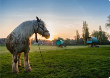
Gypsy & Travellers
- Whilst it is unlikely that gypsy and traveller accommodation will come forward in this location any provision for Gypsy & Travelling Showpeople should meet the following guidance:
- Be accessible to local services, schools, health and shopping facilities, preferably on foot, by cycle or on public transport.
- The site should be safely accessed to and from the highway by all vehicles using the site on a regular basis.
- Proposed sites should not result in significant harm to the landscape and rural character of the area, when considering matters such as the local landscape character, the cumulative effects of development alongside existing lawful caravans; existing landscape features; and long-term screening.
- Sites must not be in locations that are inappropriate for ordinary residential dwellings unless exceptional circumstances apply.
- Sites should not be in an area at risk of flooding based on the latest information from the Environment Agency, and in line with the latest NPPF and associated guidance or be located on contaminated land.
Local Plan Review Policy: LPRSP4(B), LPRSP10(A), LPRHOU5, LPRSP4(B), LPRSP14(c), LPRSP15 (5 )
Affordable Housing
6.9.9. The adopted Local Plan confirms a target for 40% affordable homes. Based on the indicative number of homes to be delivered by the masterplan, this equates to a total of up to 800 affordable homes in the Garden Community.
6.9.10. The Council's preferred approach is that the applicant builds and transfers the completed homes either to Maidstone Borough Council or to a Registered Provider for rent or shared ownership.
6.9.11. Decisions on the tenure mix will be made against the Council's requirements as set out in policy LPRSP10(A) of the LPR and the current Affordable Housing SPD in place at the time that an application is considered. Historically the demand in this location is for 1-to- 3-bedroom houses.
Provision for Gypsy & Travelling Showpeople
6.9.12. Policy LPRSS1 sets out that the council will seek to meet the culturally appropriate accommodation needs of the borough's Gypsy, Traveller and Travelling Showpeople communities over the plan period.
6.9.13. The council is preparing a separate Gypsy, Traveller and Travelling Showpeople Development Plan Document (GT DPD) detailing how and where these identified accommodation needs will be met. It is recognised that this type of accommodation is an integral part of the borough's overall housing provision and should be considered from the outset when creating mixed and balanced communities.
6.9.14. At this stage, work is still ongoing to identify the exact number of pitches/plots that can be provided on existing sites, and which sites these will be. This includes those site allocations contained within the Local Plan Review.
6.9.15. The emerging GT DPD (Regulation 18b, preferred approaches) highlighted the potential for the Garden Communities at Heathlands and Lidsing to accommodate new Gypsy and Travelling Showpeople sites, due to their scale, strategic significance in meeting local housing needs and anticipated long delivery timescales. The full proposed list of sites will be published at the Regulation 19 stage, alongside the detailed Pitch Deliverability Assessment (PDA).
Q23: Please set out any changes that you think should be made to the principles & guidance for "Housing". View representations
6.10. Sustainable & Healthy Design
6.10.1. The National Planning Policy Framework is very clear that healthy and sustainable design are key to plan making. It embeds climate change adaptation and mitigation at the heart of the planning system and reflects the Government's objectives for the transition to Net Zero carbon by 2050.
Climate Change Mitigation
6.10.2. At the local level, Maidstone Borough Council has approved a motion recognising the global climate change and biodiversity emergencies. It has also adopted a Biodiversity and Climate Change Strategy and Action Plan, which the Local Plan Review helps give effect to.
6.10.3. The principal strategic planning policy is LPRSP14(C) Climate Change, however as a cross-cutting topic area there are other relevant policies set out across the plan. This includes policies on sustainable transport, energy use and carbon reduction, flood risk management, waste management, biodiversity and green infrastructure.
Orientation
6.10.4. Following the National Model Design Code, development in the Lidsing Garden Community should ensure that there are good levels of natural lighting to aid health and energy efficiency. An example of how best to achieve this is in Figure 37.
Safety & Securing
6.10.5. Community safety is a key component of any successful place. An important design aim is to ensure the new neighbourhood will feel safe and secure at all times, encouraging full use of its streets and spaces by all sections of the community.
6.10.6. In addition, as referenced by Building Regulations Part Q, applicants must consult the Secured by Design Guides to ensure safety and crime prevention measures are integrated throughout the development.
6.10.7. As part of Detailed Planning Applications, discussions will need to be held with the local crime prevention officer, covering defensible space, natural surveillance and access to open areas.

Climate Change
- The overall design and layout of the development must incorporate measures to adapt to climate change and consider how the wider site level renewable energy is integrated.
- Buildings must be designed to adapt to climate change and avoid overheating.
- Passive cooling should be used rather than mechanical ventilation or cooling.
- A climate change mitigation strategy is expected with any future planning application that will include:
- An outline of how renewable energy is produced on site;
- How buildings are to be designed to be adaptable to climate change over time;
- How development will cater for active travel;
- Water saving measures to be employed in all buildings.
- Buildings should be designed to have solar PV panels on them in order to maximise the use of renewable energy production.
- Buildings should be designed to meet the policy requirement of water consumption of no greater than 110 litres/person/day. This could be achieved via additional grey water storage and reuse measures or water efficiency measures or a combination.
- The planning application should be supported by a energy, carbon and sustainability strategy.
Orientation
- Any future planning application should be accompanied by a passive solar design analysis to influence the layout of the development on site.
Safety & Security
- To achieve safety and security, the principles of Crime Prevention Through Environmental Design (CPTED) must be applied to all future proposals:
- Physical security: individual buildings/ dwellings must include appropriate measures to ensure that they can withstand attack.
- Surveillance: residents must be able to observe the areas surrounding their home. Surveillance can be facilitated by ensuring that front doors face onto the street, that areas are well illuminated, and blank walls are avoided.
- Movement control: opportunities for unnecessary access, egress and through movement should be avoided. High levels of through movement allow offenders to access and egress an area; permits identification of targets and increases anonymity.
- Management and maintenance: processes are in place to ensure that a development is free from signs of disorder. This signals that the area is cared for.
- Defensible space: the ownership of space in a neighbourhood should be clearly defined. For example: public (e.g. pavement); semi-public (e.g. front garden); semi-private (e.g. rear garden) and private (e.g. inside the home).
- Buildings should front onto the street and communal areas to allow for natural surveillance.

Biodiversity
- A future planning application should be cognisant of the need to design for nature and as such should incorporate the following in its design:
- Native trees;
- Hedgehog highways;
- Hibernacula/wood piles; and
- Bird and bat boxes.
- A network of green corridors and spaces across the site; including a diverse habitat mosaic (i.e. woodland, hedgerows, wetlands etc) will be created to support 20% BNG on site.
- Development will provide for BNG through a range of measure such as green/brown roofs, green walls, rain gardens, swales (including wet and bio) and biodiverse grasslands within the built form.
- The development should incorporate integrated ecology and biodiversity measures such as appropriately sited bird, bat and bee bricks and boxes.
- Soft landscape design to include native tree and shrub species, wildflower meadows and wetlands, and habitats for insects and invertebrates where appropriate.
- Ancient and broadleaved woodlands and veteran trees within the site must be retained with green space layout designed to reconnect woodland habitat. The planning application should aim to retain grade A and B trees. Losses must be mitigated, including the planting of at least two native trees for every tree removed and the retention of the cut wood on site for habitat creation.
- Existing hedgerows must be retained wherever practical. Losses must be mitigated, with native hedgerow creation informing the landscape and domestic boundary strategy across the development.
Health
- Residential properties should have a private amenity space as per policy LPRQD7 of the Local Plan Review. This should enable outdoor growing space as per the garden community principles from the Town & Country Planning Association.
- Residential properties should have storage facilities for waste that are accessible.
Water Management
- The SuDS strategy must be fully integrated into the natural water cycle.
- Natural watercourses must be respected and utilised within the SuDS strategy.
- The water cycle must be celebrated with a range of new water courses and features that use rainwater to benefit nature and residents alike.
Habitat Regulation Assessment
- As per the Local Plan Review Policy the Council would expect a project level habitat regulation assessment as part of any forthcoming planning application to confirm mitigation measures to address the potential air quality impacts on the North Downs Woodland Special Area of Conservation. Any mitigation measures will need to follow best practice guidance and not make the situation worse.
Local Plan Review Policy: LPRSP4(B), LPRHOU5, LPRSP4(B), LPRSP14(c), LPRSP15 (5 )
Biodiversity
6.10.8. In accordance with LPR Policies LPRSP14(A) and LPRSP4(B) 20% biodiversity net gain will be achieved on site through a range of measures that include the retention and enhancement of the most biodiverse habitats.
Health
6.10.9. The Council is clear that it supports healthy places. Within its corporate strategy the Council has two aims 'Resilient Communities' and 'Quality Homes for All' where it seeks to reduce health inequalities within the Borough. The Garden Communities have a key role to play in that task. The data suggests that the main health issues within the Borough are: ageing population, dementia, and cardiovascular disease.
Water Management
6.10.10. The Garden Community should implement drainage strategies that consider sustainable drainage techniques that work with the natural drainage of the site to retain surface water within the site and manage the risk of flooding during severe storms.
6.10.11. Consideration should be given to the constraints of the site in regard to the proposed drainage layouts and ensure that any existing risks are fully considered and managed appropriately.
6.10.12. The surface water drainage strategy should mimic natural discharges where possible. Surface water discharge via re-use should be considered with rainwater harvesting utilised where possible. Surface water discharge via infiltration should be considered where appropriate and evidence such as soakaway tests submitted to demonstrate they meet LLFA requirements.
Habitat Regulation Assessment
6.10.13. Policy LPRSP4(b) criteria 7 (g) (i) requires development proposals (those that come forward through a planning application) to demonstrate a project level HRA that sets out the relevant material required, this is further expanded upon in the LPR paragraphs 6.89 & 6.90. This additional work will build upon the plan level HRA that was produced alongside the Local Plan Review.

Q25: Please set out any changes that you think should be made to the principles & guidance for "Sustainable & Healthy Design". View representations
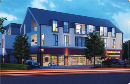
6.11. Local Centre
6.11.1. Local Centres have 'town centre' status in the National Planning Policy Framework and as a result, are covered by the NPPF's town centre policies. Appropriate town centre uses are set out in the NPPF and include retail, leisure, entertainment, arts, cultural, tourism and community use.
6.11.2. Maidstone's LPR policies LPRCD1 Shops, facilities and services, and LPRSP11(C) Town, District and Local Centres, define the retail hierarchy in Maidstone and set out appropriate uses for District and Local Centres that ensure they maintain and enhance the retail function and support community uses.
6.11.3. The policy notes that new Local Centres will be established at Lidsing Garden Community to serve the needs of local residents and should be of an appropriate scale to the site whilst not undermining the role or function of other centres within the retail hierarchy. It is further defined in the Policy LPRSP4(B) criteria 4(c) to be a local centre at Lidsing Garden Community.
6.11.4. Local centres include a range of small shops serving a small catchment.
6.11.5. The proposed Local Centre at Lidsing Garden Community is proposed to be located at the centre of the development adjacent to the school site. The origins of the siting of the village centre within the masterplan framework derive from four core locational principles:
- Strategic landscape and SUDs framework
- Connectivity and road infrastructure
- Proximity to proposed employment area
- Relationship to the development to its wider context
Strategic Landscape and SuDS Framework
6.11.6. The proposed layout of the development has been informed by detailed technical analyses and the desire to create a series of green pathways, and specifically linkages between the National Landscape to the south and the Capstone Farm Country Park to the north.
6.11.7. The proposed positioning of the village centre within this wider green and open space pathway structure is an important element of the development, given its centrality alongside the proposed village green as part of a wider movement corridor within and through the site, north-south and east-west.
Connectivity and Road Infrastructure
6.11.8. A key benefit of the proposed garden community at Lidsing is the creation of linkages through the site, benefiting the functioning of the wider transport network. The early construction and the alignment of the east-west road link and the desirability of creating a village centre node at a key connection point of the movement for pedestrians, cyclists, cars, and buses directly underpins the location of the proposed village centre and facilities.
6.11.9. With delivery of the link road proposed to commence early in the phasing of the development, the creation of a hub in this location will help to centre the organic growth of a new community, allowing for the building of local identity and community connections from the earliest phases of the development.
Proximity to Proposed Employment
6.11.10. The proposed village centre will be located close to the edge of the proposed employment land, allowing for a degree of synergy between the functioning and use of these two areas, fostering the viability of both the village centre facilities and the vitality of the employment hub. It is relevant that the siting of the village centre will also complement the phasing of the development and link road connectivity.
Relationship of the Development to its Wider Context
6.11.11. The physical relationship of the proposed development to existing and planned development in the wider context of the site has been considered. Whilst residents will benefit from higher order services nearby through improved connectivity to these urban areas – specifically at Hempstead and Lordswood - Lidsing Garden Community will retain a centrally located provision of facilities to serve local everyday needs, including a primary school, health facilities and lower order facilities.
6.11.12. The location of the proposed village centre would not disproportionately serve residents within one particularly part of the site; the central siting of the proposed village centre allows for a broadly concentric layout across the wider site area, facilitating access for residents in relatively equal distance across the majority of the proposed development.
Key Principles/Guidance:
Local Centre
Overview
- The Local Centre will come forward no later than Phase 2 of the development to ensure the number of new residents that have moved into Lidsing achieve sufficient critical mass to support its commercial activities. It shall be designed following several principles:
- A 'Mobility Hub' to provide for EV charging, car clubs, bus stops and active travel routes;
- 1,500 sqm commercial/retail/leisure and services floorspace;
- Be sited around or close to part of the amenity green space in the form of a village green;
- Creation of a public space capable of staging local events and markets;
- Creation of a community space.
- The Local Centre will be co-located with the new primary school, to allow for community use of the school.
Mix of Uses
- The Precise mix of Local Centre uses will be determined at the pre/planning application stage in consultation with the Council and informed by market advice, but the Maidstone Garden Settlements Economic Report (May 2021) should be used as a starting point subject to commercial considerations. However, it is expected that the Lidsing Local Centre will include the following key components:
- Convenience goods;
- Comparison goods;
- Food and beverage facilitates;
- Non-retail elements.
- High quality public realm including hard and soft landscaping, external seating, a play area, trees and planting.
Medical Facility
- The healthcare facility should either be a fully fitted healthcare centre of a size and specification to be approved by the NHS, to be provided and transferred to the NHS at nil cost, or equivalent funding provided to mitigate the need for this development at an alternative site following strategic assessment as part of the NHS future planning analysis as part of the planning application process.
Meanwhile Uses
- A meanwhile use strategy should be provided to ensure that facilities are in place to support the community's needs from phase 2 of the development.
- Up-to-date assessments of local community needs must be produced to inform the detailed plans for the local centre.
Local Plan Review Policy: LPRSP4(B), LPRSP14(c), LPRSP15, LPRQD1, LPRQD2, LPRQD3
Mix of Uses
6.11.13. For the Local Plan Review 2021-2038 a Garden Communities Economic Report was commissioned to ascertain the floorspace requirements for retail and employment. One element of the report focused on the best possible combination of the floorspaces for the Lidsing Garden Community Local Centre considering its proximity to existing retail areas. It outlined that approximately 1,500sqm of retail floor space was required and this is in Policy LPRSP4(B). It also reviewed the break down between comparison, convenience, food and beverage and other floor space and guidance has been provided below on this.
6.11.14 A proposed sketch layout for the Local Centre can be found in Figure 38 and should be developed as part of the design code.
Medical Facility
6.11.15 Local Plan Review Policy LPRSP4(B) identifies the need for the site to deliver a new medical facility in phase 2 of the development alongside the new local Centre.
6.11.16 Locating the medical facility within the local Centre will maximise convenience and accessibility and encourage linked trips within the Centre.

Meanwhile Uses
6.11.17 As the Garden community emerges, so will the demand for commercial uses and supporting infrastructure. It is unlikely that the initial population in early phases will be able to sustain these uses as such meanwhile or temporary uses should be established to ensure that basic community needs are met when the first residents move in.
6.11.18 Meanwhile uses may be subsidised, or form part of a commercial strategy. For example, locating a marketing suite and construction offices within vacant village centre units will direct on-site workers and visitors to the village centre, who will assist in creating sufficient footfall to make a local shop viable. Alternatively, pop-up shops or indoor markets may create visitor destinations which also serve the local population.
6.11.19 A meanwhile use and letting strategy must be prepared for the village centre and submitted as part of a planning application. This will need to demonstrate how temporary facilities can be provided to cater for residents needs during the early stages of the development programme, before a sufficient population is established to make a fully occupied village centre vibrant.
Schools must act as a key community facility. Consideration should be given to how some spaces within the school, including the sports provision, could be utilised for community uses during and outside school hours, if needed.
Q26: Do you agree with the principles & guidance for "Local Centre"? View representations
Q27: Please set out any changes that you think should be made to the principles & guidance for "Local Centre". View representations
6.12. Education
Primary Education
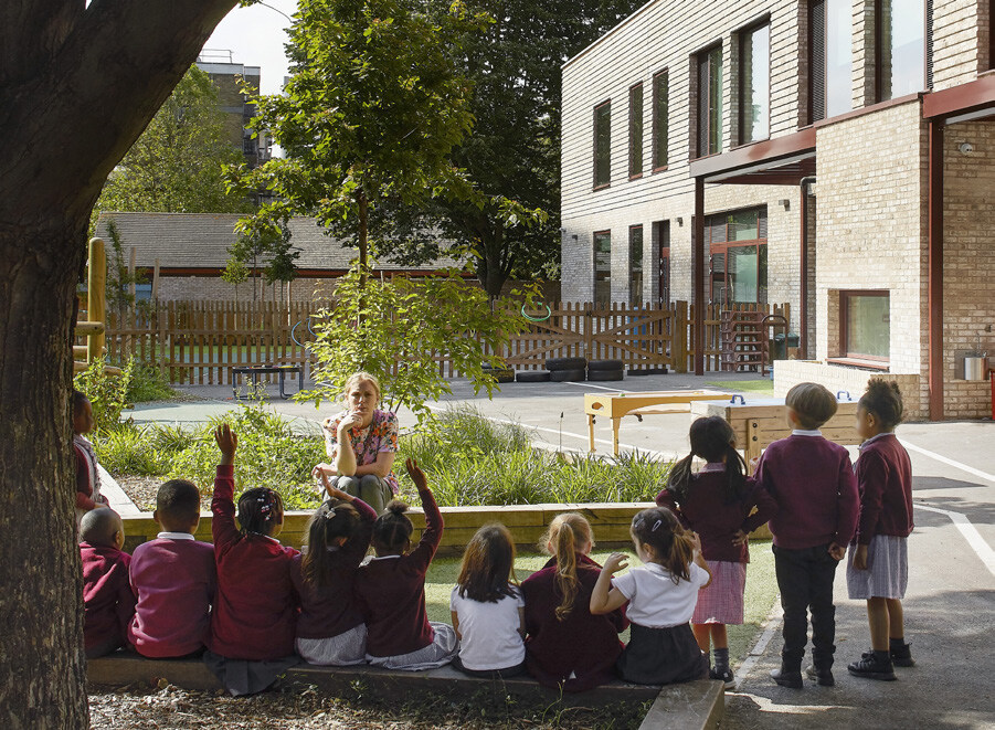
6.12.1. Policy LPRSP4(B) criterion 5 (b) requires the new 3 form entry primary school to be provided in the Lidsing Garden Community. The school should be in an accessible location, enabling children the opportunity to safely walk, wheel and cycle to school.
6.12.2. It is envisaged that during the early phases of the development there is capacity within the existing schools in Kent, such as Bredhurst Primary School which shall be used prior to the development of the new school.
6.12.3. The local education authority for the site is Kent County Council. In 2023 the Council adopted a new Developer Contributions guide for relevant county level infrastructure including education. This guidance sets out the approach to design and use of education facilities.
Secondary Education
6.12.4. Policy LPRSP4(B) is clear that no secondary education facility needs to be provided on the site, but that a contribution is to be provided towards the provision of secondary education provision.
Key Principles/Guidance:
Education
Primary School
The primary school should achieve the following principles:
- The areas of land identified in the Framework Masterplan (approximately 3 hectares) is safeguarded for the provision of primary education.
- School buildings must be well-designed, attractive, landmark buildings that are innovative and create a good learning environment.
- The building must allow for flexible uses and must provide generous floor to ceiling heights.
- Sports provision must be provided. This must be primarily for the use of the primary school, but should also be designed to support community uses, if needed in the future.
- Areas surrounding the school must have safe drop off zones. Schools must be accessed by safe and direct walking and cycling routes.
- A travel plan will be required, in order to reduce the use of private cars.
- The provision of Early Years facilities within the primary school will be encouraged.
- Schools must be easily accessible to users with different abilities.
- Opportunities for outdoor learning on site are to be explored.
- Schools must act as a key community facility. Consideration should be given to how some spaces within the school, including the sports provision, could be utilised for community uses during and outside school hours, if needed. Separate entrances to supporting buildings/ spaces could help facilitate this.
- Community uses provided within schools must explore methods of funding and suitable management arrangements, as well as securing formal community use agreements, which will ensure that the community uses are well managed in the future.
- The school must be designed to be carbon zero.
Secondary School
- Contributions towards secondary education are to be provided and to the relevant education authority agreed between Kent County Council and Medway Council based on the need.
Q28: Do you agree with the principles & guidance for "Education"? View representations
Q29: Please set out any changes that you think should be made to the principles & guidance for "Education". View representations
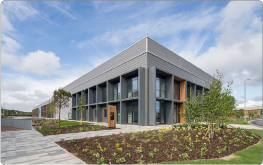
6.13. Employment Area
6.13.1. Land to the south east of the site is to be used as an employment area as per the framework masterplan in Policy LPRSP4(b). It is envisaged that this will be a mixed use location and broadly conform to the principles set out below.
6.13.2. The Masterplan identifies a 14ha area (gross) of employment land positioned close to the motorway. The employment land will serve to meet not only the needs of the garden community but will 'inbuild' some flexibility for meeting employment demand from the adjoining Medway urban area and/ or the wider geographical area attracting investment and job creation opportunities to this location.
6.13.3. The 14ha employment hub will comprise a flexible mix of office, light industrial, and storage/ warehousing units with a target mix of floorspace:
1. Office (15%;
2. Light industrial uses (35%);
3. Storage/warehousing (50%).
6.13.4. As the Lidsing Garden Community develops the employment land will be made available in phases to align with delivery of houses so local employment opportunities are available to new residents. This approach is possible in this case because of the long-term position the landowner is prepared to take.
6.13.5. The employment land will be located close to the M2 motorway Junction 4 which will have a direct link to a new road spur and this level of accessibility is expected to be highly attractive to employment investors. The quality of the environment created, which benefits from excellent road links to the motorway network and will provide serviced land within a quality landscaped setting, will maximise investment interest and can provide opportunities in the short medium and long term through freehold or lease arrangements.
6.13.6. It is a central garden community principle to provide employment and other supporting uses alongside housing which this proposal delivers, and the target is to provide a total of at least 2,000 jobs. The employment area identified is set within a landscaped framework and has been positioned close to the M2 motorway junction (J4) and its spur.
6.13.7. It is relevant that the specific design and layout of development within this employment hub must contribute to the statutory requirement to conserve and enhance the Kent Downs National Landscape, due south of the M2. This "hub" will form a core employment area to serve the garden community whilst also meeting wider needs over longer timescales. This is required by Policy LPRSP4(B)(h)(i-viii).
6.13.8. A range of other jobs will be created via a community hub/ enterprise centre within the 'village heart' which could serve as a dedicated co working centre. Jobs will also be created in the 'village centre' because of the mix of uses anticipated.
6.13.9. An indicative sketch of the employment hub layout is proposed in Figure 39.
6.13.10. The development is expected to sit in the landscape and to have minimal impact on the Kent Downs National Landscape hence the prescription on heights proposed in Policy LPRSP4(B). Figure 40 provides an indicative diagram of the heights of the development.
6.13.11. High speed fibre broadband must be delivered throughout the Site to support home and mobile working and a wide variety of businesses and be delivered via either FTTP or aligned to the most up to date and appropriate technology.
Key Principles/Guidance:
- A target of 14 hectares of new dedicated employment land must be delivered within the site. This provision may be provided within a single or multiple land parcels.
- Employment areas must be designed to respond positively to the Garden Settlement character, including high-quality public realm. They should incorporate legible and attractive boundary treatments that optimise the use of green infrastructure (such as planting, trees and hedgerows). Building materials, design, heights and orientation must reflect areas of particular landscape and visual sensitivity and minimise visual impacts.
- Employment land must be located to take advantage of good access from within and beyond the site by walking, cycling, wheeling and public transport. Suitable access will also be required via highway routes to minimise impacts on residential neighbourhoods.
- Employment land must be located and designed to ensure the protection of amenity of commercial uses, as well as neighbouring uses such as housing.
- Provision should be made for a wide range of employment uses within defined employment areas within the site, including Use Class E (Commercial, Business and Service), B2 (General Industry) and B8 (Storage and Distribution). A range of building typologies should be provided to cater for a variety of types and sizes of businesses. This may include office space, industrial or warehouse units or hybrid workspaces.
- Workspaces should be designed to be flexibly specified, so that they can be adapted to a wide range of employment uses and end-users over their lifetime.
- Development proposals will be supported where they provide low-cost or affordable workspace.
- An integrated approach to parking, servicing and deliveries will be required to minimise conflict between different land uses and to make the development safe for all users. Heavy Goods Vehicles should be kept separate from key walking and cycling routes and public spaces, where possible.
- Development must be designed to enable the provision of superfast broadband with Fibre to the Premises (FTTP) or aligned to the most up to date and appropriate technology.

Local Plan Review Policy: LPRSP4(B), LPRHOU5, LPRSP4(B), LPRSP14(c), LPRSP15 (5 )
Q30: Do you agree with the principles & guidance for "Employment Area"? View representations
Q31: Please set out any changes that you think should be made to the principles & guidance for "Employment Area". View representations