Lidsing Garden Community SPD
1. Introduction
This Supplementary Planning Document relates to the Lidsing Garden Community , which was identified and allocated in the adopted Maidstone Borough Local Plan Review (LPR) 2021-2038.
1.1. Lidsing Garden Community
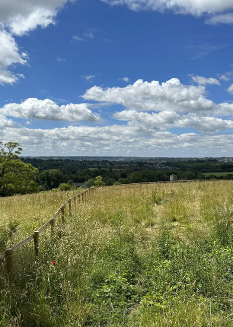
1.1.1. This Supplementary Planning Document relates to the Lidsing Garden Community , which was identified and allocated in the adopted Maidstone Borough Local Plan Review (LPR) 2021- 2038. It provides a unique opportunity for a new garden community fit for the 21st century. Since Lidsing Garden Community was allocated as a site allocation in the Maidstone Borough Local Plan Review 2021 – 2038 (LPR), in line with Policy LPRSP4(b) Maidstone Borough Council has been working with stakeholders, the local community, and the landowner to provide further guidance and to develop a masterplan framework for delivering a high-quality, sustainable new garden community based on the garden city principles.
1.1.2. This document builds on the work of the LPR and provides guidance to influence the subsequent planning applications for the site.
1.2. What is a Supplementary Planning Document?
1.2.1. This Supplementary Planning Document (SPD) is a planning guidance document which will support the delivery of the Lidsing Garden Community site allocation as set out in the Council's adopted Maidstone Local Plan Review Policy LPRSP4(b). It does not introduce new planning policy but provides further guidance on the adopted Local Plan to help shape delivery of the Garden Community. This SPD is not part of the statutory Development Plan but it is a material consideration in decision making. SPD's can also help stakeholders to understand the policy requirements so there is clarity on outcomes.
1.2.2. Maidstone Local Plan Review Policy LPRSP4(b) requires collaboration between public and private sector organisations to produce an SPD proactively and collaboratively for the Lidsing Garden Community. It is important to make sure that all of those organisations work together to achieve shared objectives and avoid piecemeal development arising from competing interests.
1.2.3. This SPD is informed by collaborative planning and design, and draws together feedback from the Council, landowners, and stakeholders. It sets out clear shared objectives which all parties should aim to achieve, alongside guidance as to how to achieve them.

1.2.4. The purpose of this SPD is not to repeat the Local Plan Review Policies. Instead, it sets out broad principles to show how the Garden Village should be designed, translating the policy requirements in the Local Plan Review into a well-designed and successful place. It also provides detailed guidance which interprets the Local Plan Review policies in a manner appropriate to the site.
1.3. About this Supplementary Planning Document
1.3.1. The process to get to this point has been over several years beginning with the development of the LPR and the allocation of the site through Policy LPRSP4(b) adopted in March 2024. This follows several rounds of consultation and an examination by a Government appointed Planning Inspectorate and Main Modifications Consultation following the examination, the contents of which were then adopted into the LPR document.
1.3.2. The Lidsing Garden Community SPD is a requirement of the Local Plan Review 2021-2038 Policy LPRSP4(B). It states:
'The council will work with the promoter to produce an agreed Supplementary Planning Document to masterplan and facilitate the site's delivery.'
1.3.3. A Lidsing Vision Document Masterplan Framework was produced by the site promoters to support the allocation in the Local Plan Review 2021-2038. This was built upon by this SPD to create a master plan framework.
1.3.4. To inform this supplementary planning document (SPD), a range of technical analyses and site-specific assessment has been undertaken. This includes work from the Maidstone Local Plan Review 2021- 2038 to support the allocation of the site and some new topic papers that summarise previous work and update where necessary.
1.4. How has the SPD been Prepared?
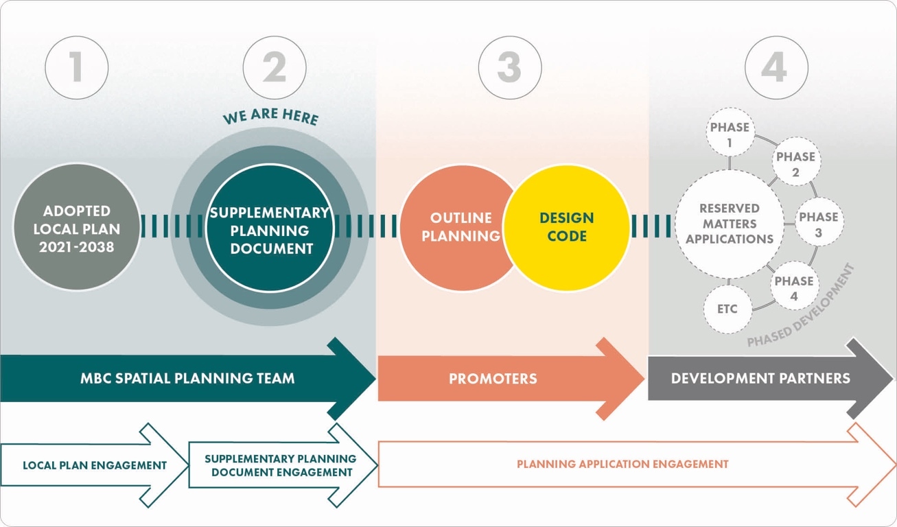
1.4.1. The SPD was developed through a series of work stages that are highlighted in the diagram below.
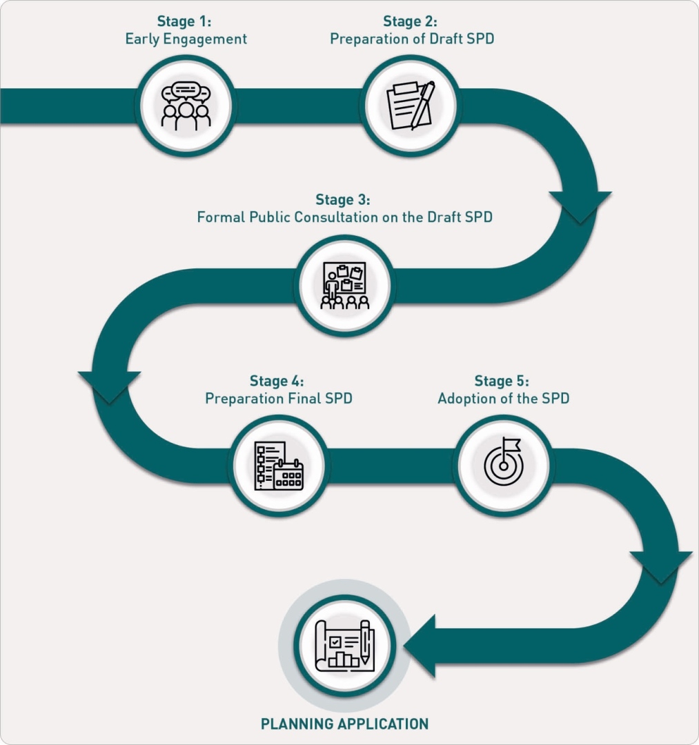
Stage 1: Early Engagement
1.4.2. Early engagement with local community and key organisations.
Stage 2: Preparation of Draft SPD
1.4.3. Preparation of the draft SPD by Maidstone Borough Council.
Stage 3: Formal Public Consultation on the Draft SPD
Stage 4: Preparation Final SPD
1.4.4. Preparation of the final SPD, taking into account formal consultation feedback.
Stage 5: Adoption of the SPD
1.4.5. Formal adoption of the SPD by Maidstone Borough Council.
Planning Application
1.5. Future Stages of Work
1.5.1. The SPD is part of a process from the adoption of the LPR site allocation to the delivery of development on site. Further detailed planning application stages are to follow.
1.5.2. The core purpose of this SPD is to support and provide guidance at this stage in the planning process, prior to the submission and consideration of planning applications for the Garden Community.
1.5.3. It will be the responsibility of developers and landowners to consider all relevant policies as set out in the adopted Local Plan and this SPD as they prepare planning applications for the site. Such planning applications will need to be accompanied by more detailed designs and a full set of accompanying assessments and strategies related to specific proposals and schemes as they come forward.
1.5.4. Given the anticipated timescales for the overall build out of the Garden Community, it is envisaged that a design code will be produced following an outline planning application but prior to reserved matters. This is in order to influence the future stages of work. It is currently anticipated that development proposals are likely to come forward in 'outline' initially, supported by all necessary material to enable consideration by the Council of the overall scale and parameters of appropriate and acceptable development.
1.5.5. Subsequently, it is anticipated that the Council will then continue to consider strategies as they come forward, discharging requirements set by planning conditions and considering future 'reserved matters' applications which are anticipated to contain the full and final details prior to construction.
1.5.6. All subsequent stages of work will be subject to appropriate levels of consultation and engagement with all key stakeholders. Ultimately, Maidstone Borough Council as Local Planning Authority (together with input and consideration by Kent County Council) will retain the key decision- making role to ensure that the overall vision and objectives for the Garden Community will be realised.
2. Policy Context
The National Planning Policy Framework (NPPF) sets out the Government's planning policies for England and provides the framework both for plan-making and decision-making.
2.1. National Planning Policy
2.1.1. The National Planning Policy Framework (NPPF) has been subject to regular review and updating, with the latest version published in December 2024.
2.1.2. The NPPF sets out that the purpose of the planning system is to contribute to the achievement of sustainable development, which is translated into three overarching objectives – economic, social and environmental. Across these objectives the NPPF covers topic-based themes including boosting the supply of homes, economic growth, town centre vitality, healthy and safe communities, the effective use of land, well-designed places and meeting the challenges of climate change. The NPPF is supported by the companion National Planning Practice Guidance (NPPG).
2.1.3. The NPPF highlights how large- scale developments, including new settlements, can play a role in facilitating the delivery of new homes whilst recognising that developments of this scale require careful consideration of design quality, environmental protection and enhancement, and infrastructure delivery.
2.1.4. To be read alongside the NPPF and NPPG for the purposes of transport planning, circular 1/22 from the Department of Transport sets out a vision led approach to transport planning. Specifically the Vision and validate approach to development; and this is explored further in the accompanying transport annex for how it will be applied to the Lidsing Garden Community.
2.2. Local Planning Policy
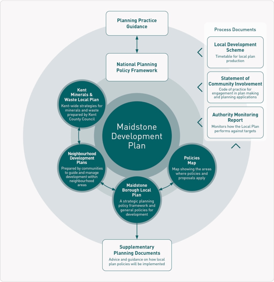
2.2.1. The Town and Country Planning Act (1990) requires local planning authorities to make decisions on planning applications in accordance with the development plan, with regard to any material considerations.
2.2.2. Maidstone Borough Council adopted a new Local Plan on 20 March 2024 (Maidstone Local Plan Review 2021- 2038).
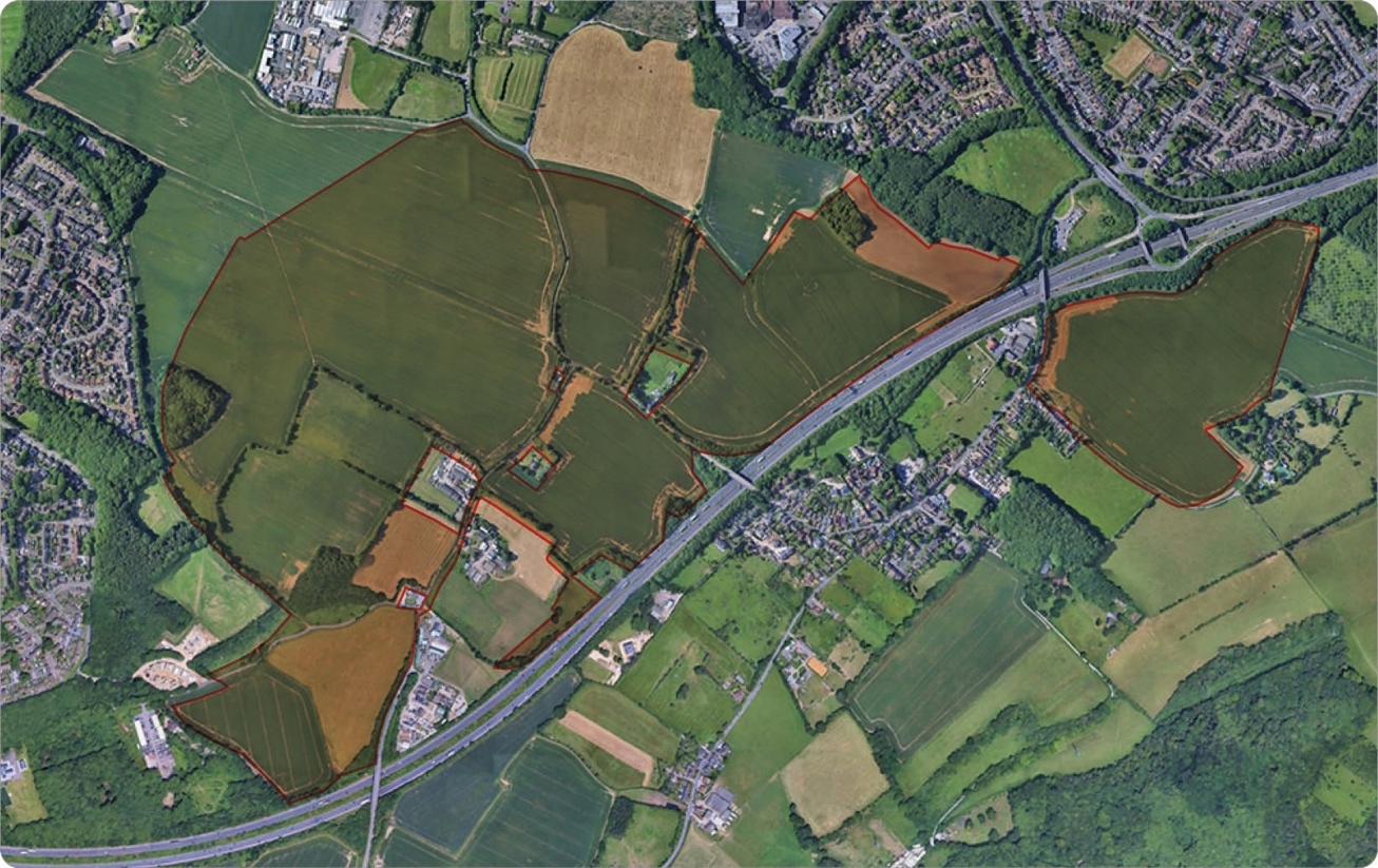
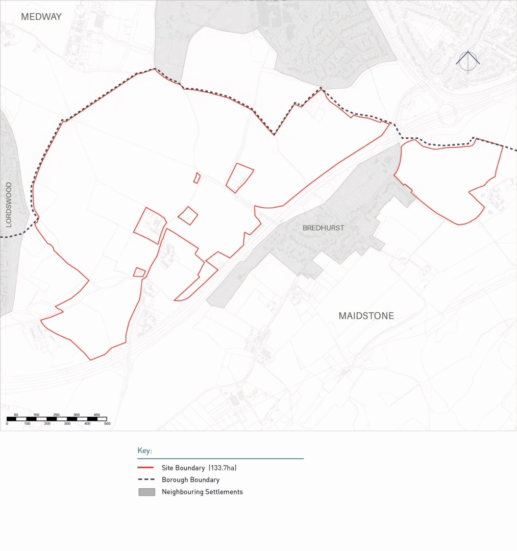
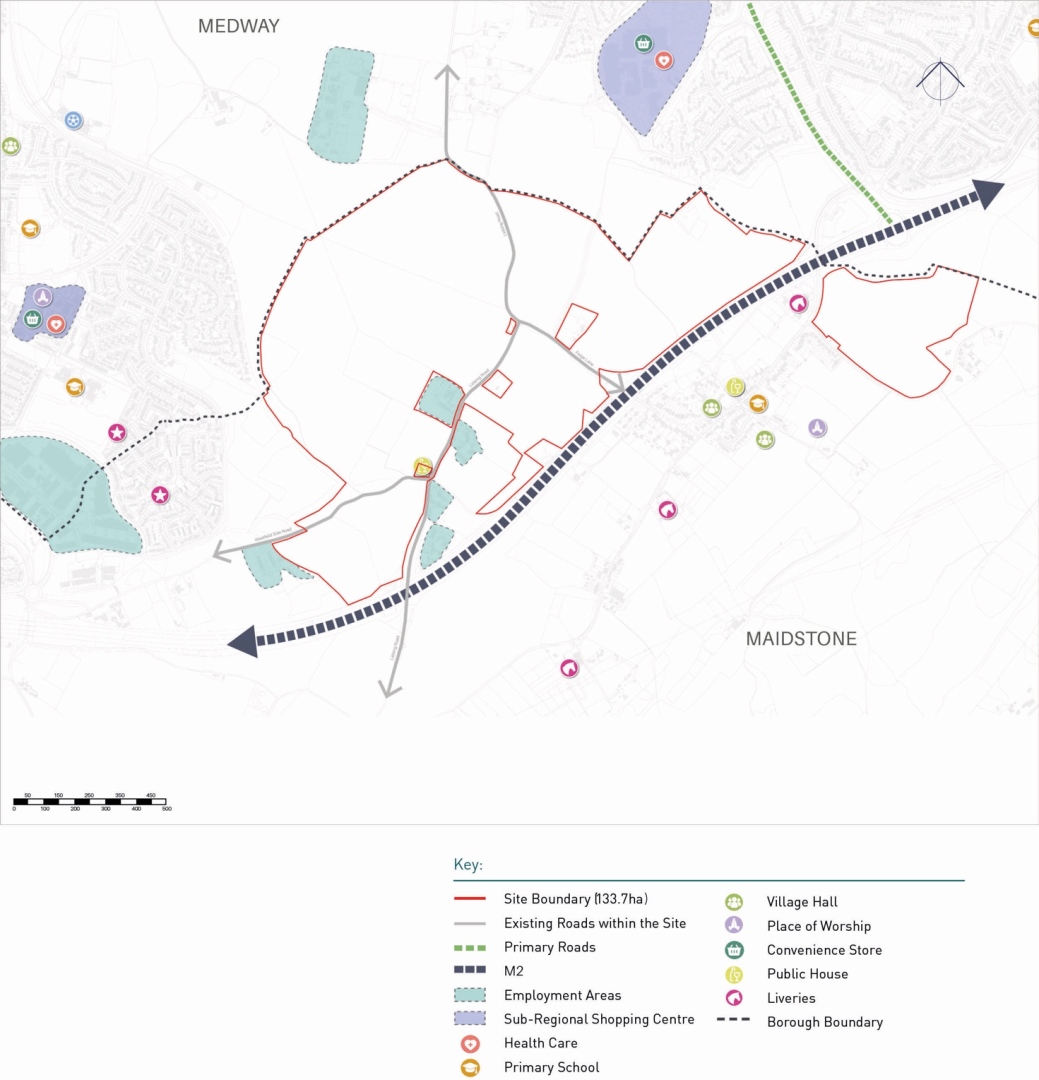
2.2.3. Lidsing Garden Community is an allocated site (133.25ha) which will allow a community of sufficient scale to deliver supporting infrastructure and amenities. The Garden Community will be an urban extension to the Medway Urban area but designed to garden community standards. Its proximity to the M2 motorway gives the site strategic connectivity, but also the provision of a new east-west link road between the areas of Lordswood and Hempstead help it to bring benefits to the surrounding area. The aim is for the site to be self-sustaining with the provision of a local centre (including a primary school) and employment area.
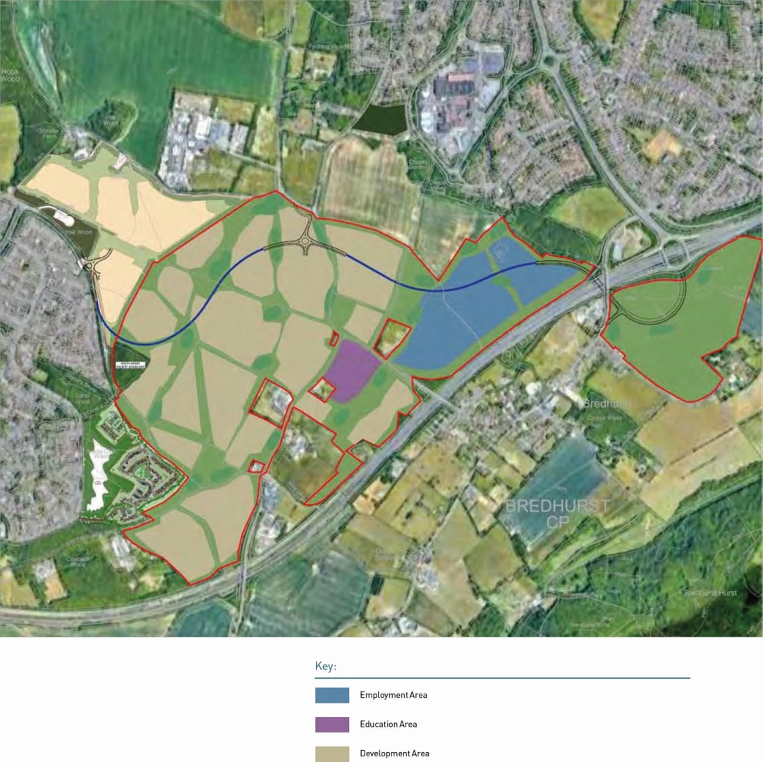
2.2.4. The Local Plan's policy framework for Lidsing Garden Community is set out in Policy LPRSP4(b): Lidsing Garden Community. This explains the overarching site requirements, land use parameters and references the promoter's original masterplan vision framework plan (see Figure 5).
2.2.5. Development at Lidsing Garden Community will need to comply with the site allocation in the Local Plan Review 2021-2038. This SPD is a material consideration which provides guidance as to how that can be achieved and should be read alongside the Local Plan Review and other documents in the Development Plan.
2.2.6. The Development Plan in Maidstone as it applies to the Site also comprises:
- Maidstone Borough Local Plan Review 2021-2038 (2024).
- Kent Minerals and Waste Local Plan (2025).
- Kent Mineral Sites Plan (2020).
2.2.7. Development proposals will need to consider the policies set out in all documents.
2.2.8. Within the Local Plan Review 2021-2038 Policy LPRSP4(b) a Lidsing Garden Community Vision Framework Plan is included at Figure 5 and is a good starting point as an indication of the land uses and development area.
2.2.9. As per Policy LPRSP4(B) the Lidsing Garden Community will consist of the following land uses; residential, employment, education, medical, retail and open spaces. The policy specifies the following:
- 2,000 residential units.
- 14ha of employment land.
- 44.07ha of open spaces.
- 1 new 3 form entry primary school.
- 1,500 sqm of retail.
2.2.10. Detailed guidance for how these uses will be developed and designed is to be found in the relevant sections of this document.
Lidsing Garden Community provides a unique opportunity for a new garden community fit for the 21st century.
Town and Country Planning Association: Garden City Principles:
- Land value capture for the benefit of the community.
- Strong vision, leadership and community engagement.
- Community ownership of land and long-term stewardship of assets.
- Mixed-tenure homes and housing types that are genuinely affordable.
- A wide range of local jobs in the Garden City within easy commuting distance of homes.
- Beautifully and imaginatively designed homes with gardens, combining the best of town and country to create healthy communities, and including opportunities to grow food.
- Development that enhances the natural environment, providing a comprehensive green infrastructure network and net biodiversity gains, and that uses zero-carbon and energy-positive technology to ensure climate resilience.
- Strong cultural, recreational and shopping facilities in walkable, vibrant, sociable neighbourhoods.
- Integrated and accessible transport systems, with walking, cycling and public transport designed to be the most attractive forms of local transport.
2.3. Design Guidance
2.3.1. There is a range of design guidance that informs the framework for the SPD and this is set out in the following paragraphs.
Garden City Principles
2.3.2. The Town and Country Planning Association (TCPA) has published Garden City Principles which reflect and build on the ethos and tradition of the 'Garden City Movement' of the early 1900s, and further reflect the modern context.
2.3.3. The principles are set out below. More information is available online at the following webpage: www.tcpa.org.uk/ garden-city-principles.
National Design Guide
2.3.4. The Government published the National Design Guide in October 2019 which supports the NPPF and its focus on design quality. It sets out ten characteristics of well-designed places, which are illustrated in Figure 6.
2.3.5. The National Planning Policy Framework sets out that achieving high quality places and buildings is fundamental to the planning and development process. It also leads to improvements in the quality of existing environments.
2.3.6. This SPD sets out how development can be carried out in accordance with good design practice and provides guidelines and principles across a number of key themes.
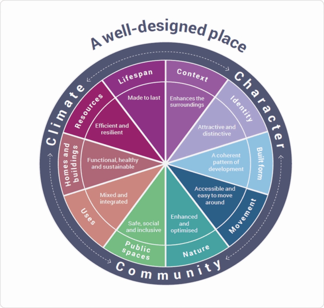
2.3.7. The National Design Guide sets out that well-designed places have individual characteristics which work together to create its physical character, help to nurture and sustain a sense of community and work to positively address environmental issues affecting climate. They all contribute towards the cross-cutting themes for good design set out in the National Planning Policy Framework.
2.3.8. The National Model Design Code provides additional guidance note on preparing design codes to take forward and expand upon the 10 characteristics of good design set out in the National Design Guide.
National Model Design Code
2.3.9. The Government published the National Model Design Code in 2020. This provides guidance for producing a design code in order to promote successful design. The document comprises two parts, a National Model Design Code which summarises the process of preparing a design code and a Guidance Note on the possible contents of a design code, the latter of which reflects the ten characteristics of well-designed places, as set out in the National Design Guide.
3. Site Context
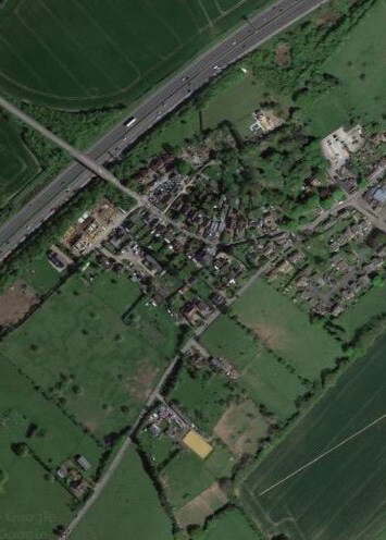
Located 37.5 miles away from London, Lidsing Garden Community is located within Maidstone Borough, adjacent to the Medway Urban Area.
3.1. Location
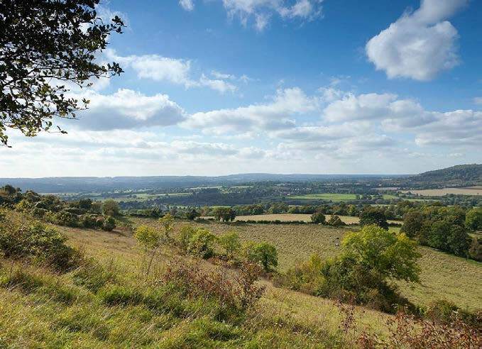
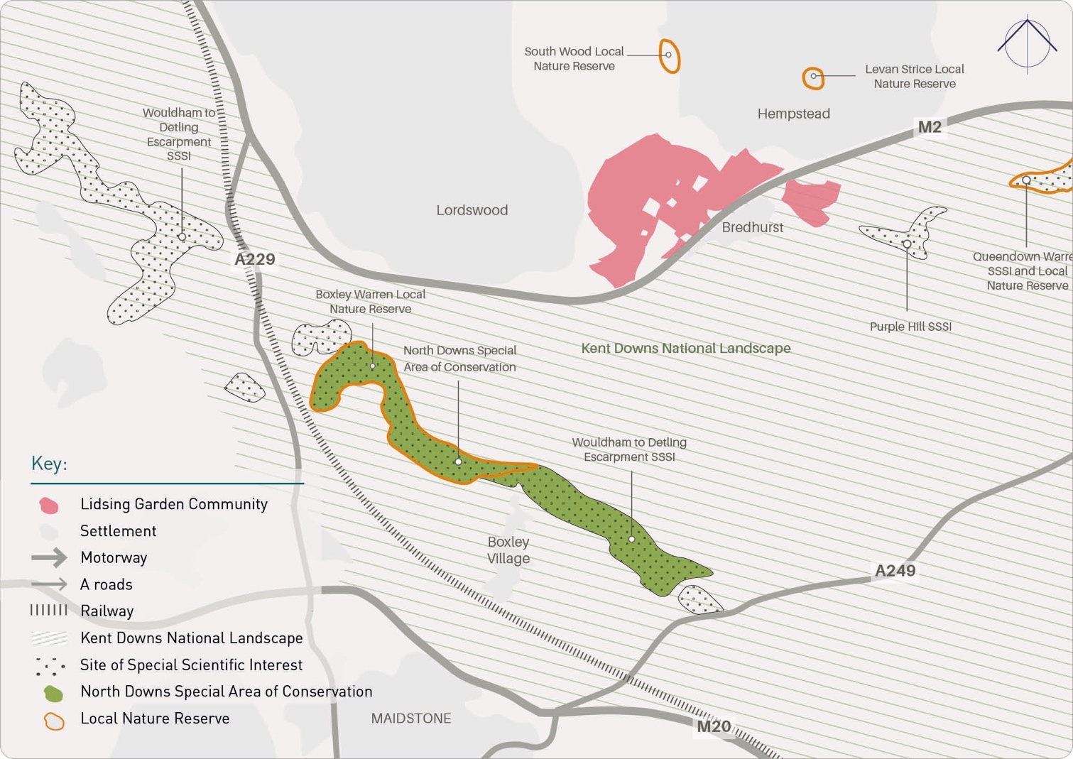
3.1.1. The site is located north of Maidstone town separated from it by, two motorways (M20 and M2) and the Kent Downs National Landscape (KDNL). The KDNL provides the strategic gap between Maidstone and the Medway urban area.
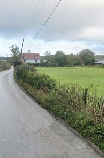
3.1.2. The Medway urban areas of Chatham Rainham and Gillingham are located to the north at the top end of the Capstone Valley, which also houses the Capstone Country Park. To the west and east lie the Medway suburban settlements of Lordswood and Hempstead. To the south are located the villages of Bredhurst and Boxley. The village of Bredhurst is located on opposite side of the M2 motorway with the village of Boxley located further south towards Maidstone town. The site is split between the Parishes of Boxley and Bredhurst. Overall residential properties in the neighbouring vary in density, value and typology.
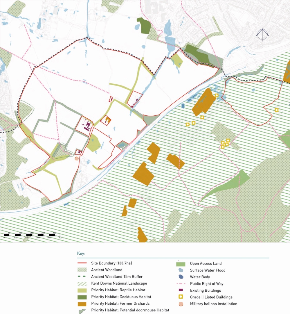
3.1.3. The site itself is formed of agricultural farmland with smaller pockets of housing within it and several rural roads and public rights of way. The site benefits from a well- established wooded and hedgerow framework in some locations on the perimeter of the Lordswood and Hempstead urban areas to the eastern and western boundaries of the site, with some of it being Ancient Woodland. Within the site there is some surface water flood risk but no designated heritage assets.
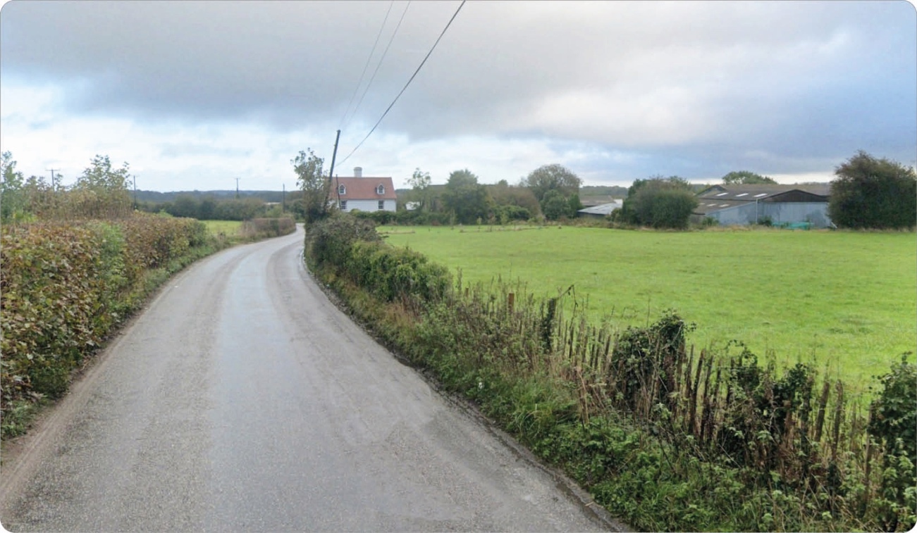
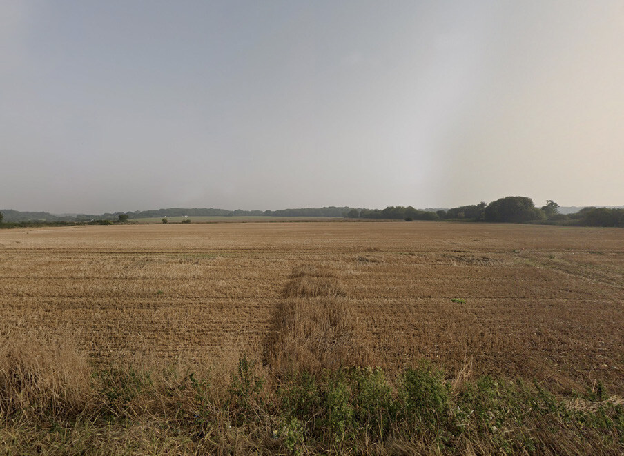

The site benefits from a well-established wooded and hedgerow framework in some locations on the perimeter of the Lordswood and Hempstead urban areas to the eastern and western boundaries of the site, with some of it being Ancient Woodland.
3.1.4. At present the allocation site is within one landownership. This landownership extends outside of the site allocation boundary.
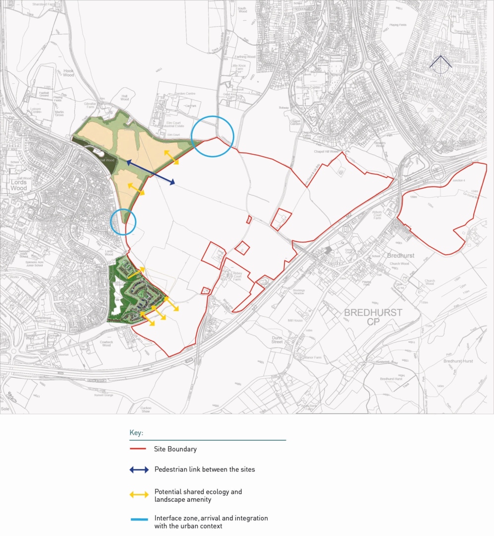
3.1.5. To the north and west are sites with planning permission and presently being developed or close to commencement. These include East Hill and Gibraltar Farm in Medway Council's area and Gleaming Wood Drive within Maidstone Borough area.
3.2. Environment & Landscape
Topography
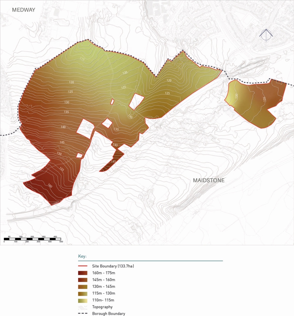
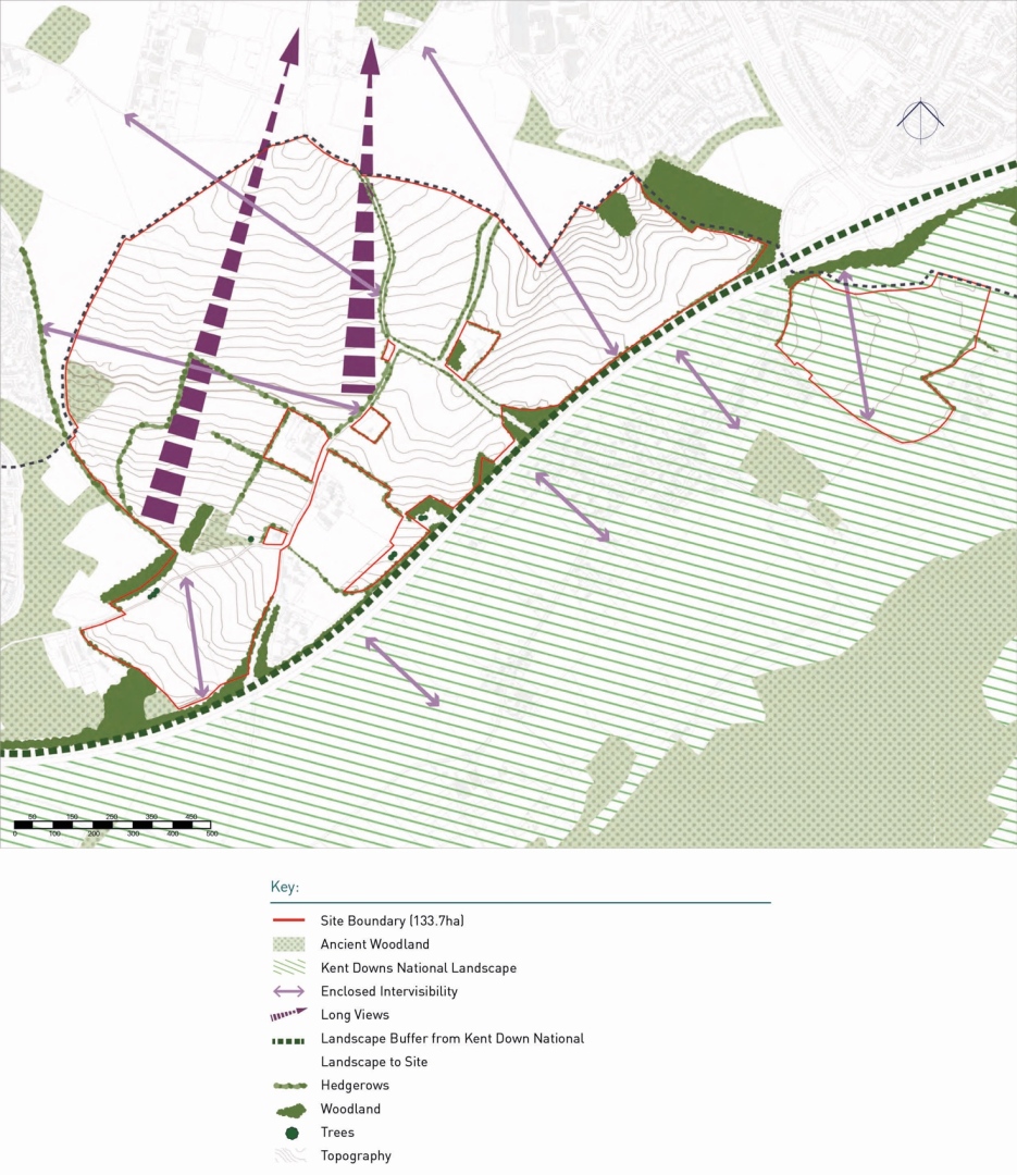
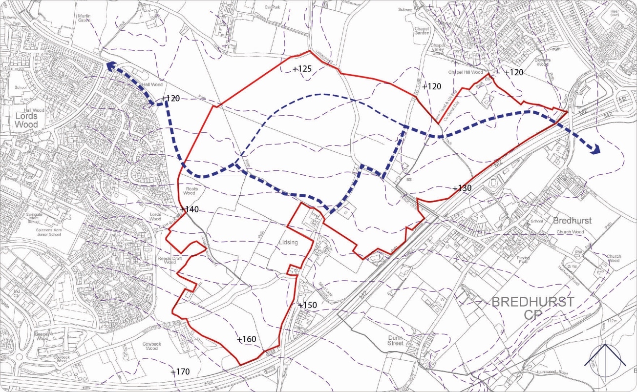
3.2.1. The site slopes gently downwards from the south to the north, with little undulation or variety in conditions. The site is slightly steeper to the south adjacent to Gleaming Wood. The slope is 175m at its' highest and then slopes to 110m at lowest at the northern end of the site (see Figure 9).

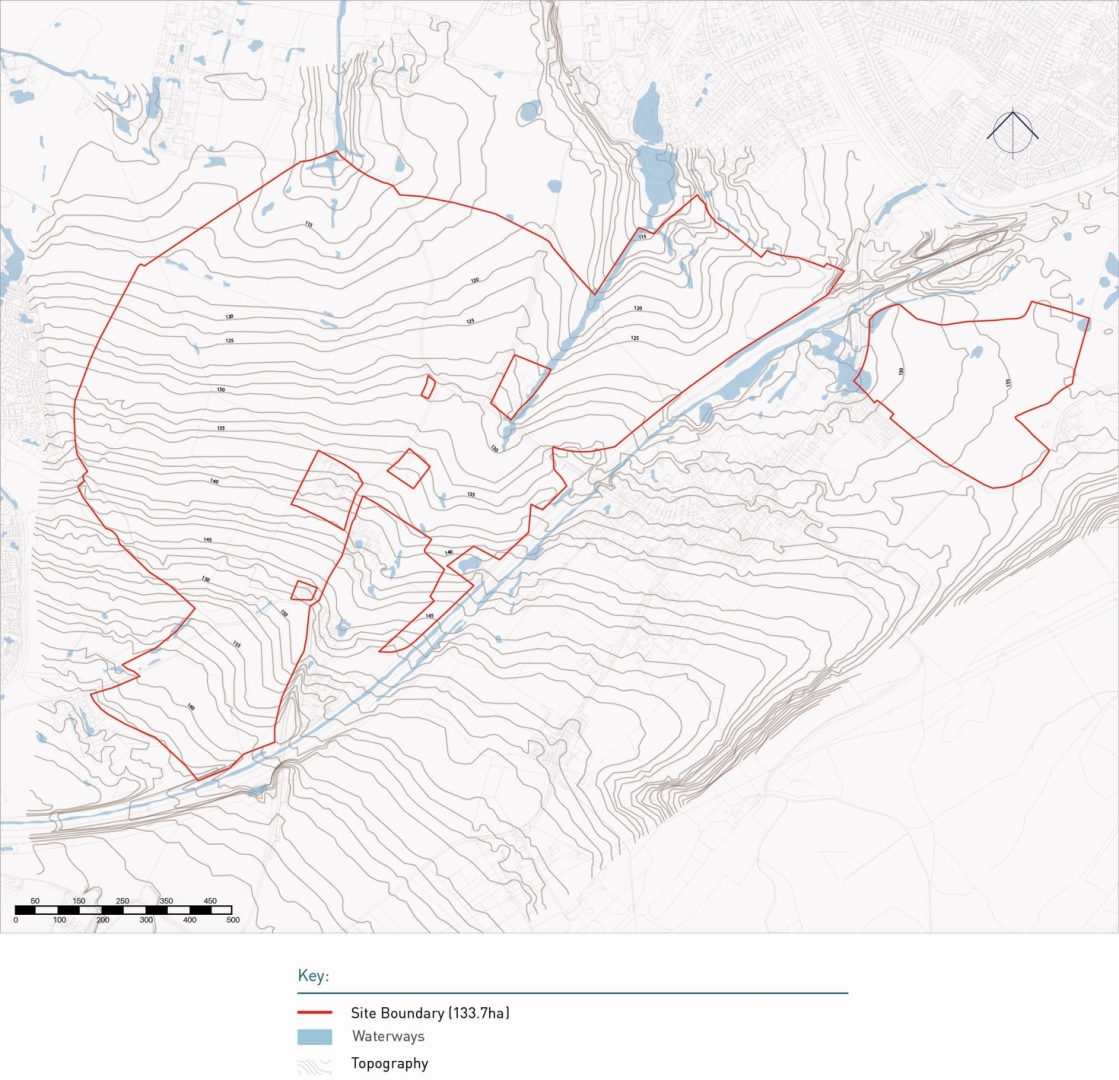
Flood Risk
3.2.2. The Maidstone Strategic Flood Risk Assessment (SFRA) indicates that the site is in Flood Zone 1 and so is not subject to any fluvial flood risk. There are areas of surface water flood risk as thin "fingers" draining to the north which are narrow and clearly defined. A second band of potential surface water flood risk to the south of the site shows a wider section of surface water draining towards Hempstead. The scheme will need to control the distribution of surface water to minimise flood risk.
3.2.3. The low flood risk has been used to define the starting point for the green infrastructure. Due to the topography, the green spaces will rarely contain water but the profile of the landscape will be such that any surface water can be accommodated, if required under an extreme event. In addition to existing high quality landscape areas and existing hedgerows on the site, the surface water strategy looks to create high quality landscape areas at the heart of the masterplan.
3.2.4. The Site is not in an area of high flood risk although within the lower lying areas, underground surface water pathways have been identified which, during extreme modelled events would carry water. The northern most area of the site is where the land is at its lowest, and as such the long views north-south across the site must be considered within the masterplan.
Ecology
3.2.5. At present the site comprises arable agricultural land with some areas of peripheral woodland, including Ancient Woodland (Roots Wood, Reeds Croft Wood & Chapel Hill Wood). Initial ecological surveys have indicated probable reptile and dormouse habitats towards the periphery of the site. Please see Figure 12 for details.
3.2.6. There are no other designated environmental assets within the site. Bredhurst Woods Local Wildlife Site is located to the south of the M2 Motorway and Bredhurst Village. Outside of the site to the north are located Hall Wood and Farthing Wood Local Wildlife Sites.
3.2.7. The emerging Kent Local Nature Recovery Strategy (LNRS) (which is a statutory consideration), Medway Green Infrastructure Strategy and Maidstone Green Infrastructure Strategy acknowledge existing habitats of importanceand recognise their existing and potential connection to the surrounding landscape. The LNRS recognises Areas of Protection for Biodiversity and Areas that Could be of Importance for Biodiversity to the west of the site, and identifies grassland, woodland, freshwater, land management, urban and connectivity potential measures throughout the site. The LNRS should inform the consideration of the creation and enhancement of new and existing habitats as part of emerging proposals for development.
3.2.8. Surveys and reports have also identified particular areas of importance for protected species to the east of the site.
Landscape Character
3.2.9. The site is located within the Bredhurst and Stockbury Downs landscape area defined by the Maidstone Landscape Character Assessment 2013. This area is characterised by the following landscape features:
- setting of the Kent Downs National Landscape,
- level to gently sloping plateau,
- a mixture of arable fields, paddocks, remnant orchards and small to medium blocks of woodland,
- mixture of historic and recent buildings traditional materials and narrow lanes in addition to the M2 Motorway.
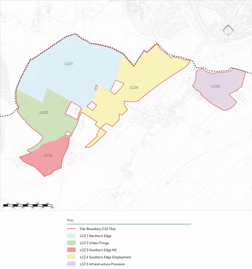
3.2.10. Building on this, further landscape appraisal work was undertaken for the Local Plan Review examination. It identified that the site has 5 distinct landscape character zones spread across the site (see Figure 14).
3.2.11. The following technical work was also undertaken to support the allocation of the Lidsing Garden Community:
- Landscape and Visual Technical Note (July 2021) .
- Landscape Capacity Study (March 2022).
- Land at Kemsley Street Road - Opportunities Plan (March 2022).
- Key Views (May 2022).

Open Spaces
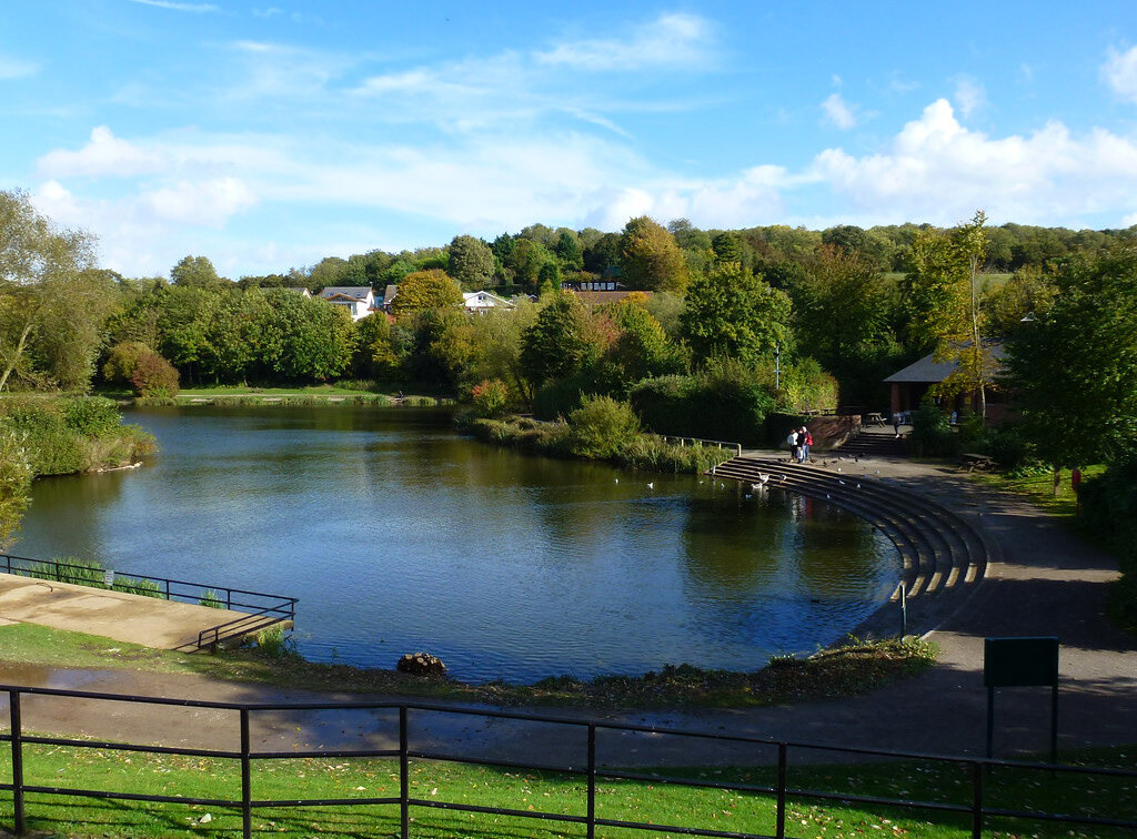
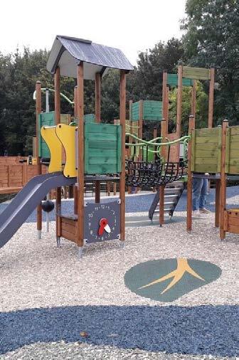
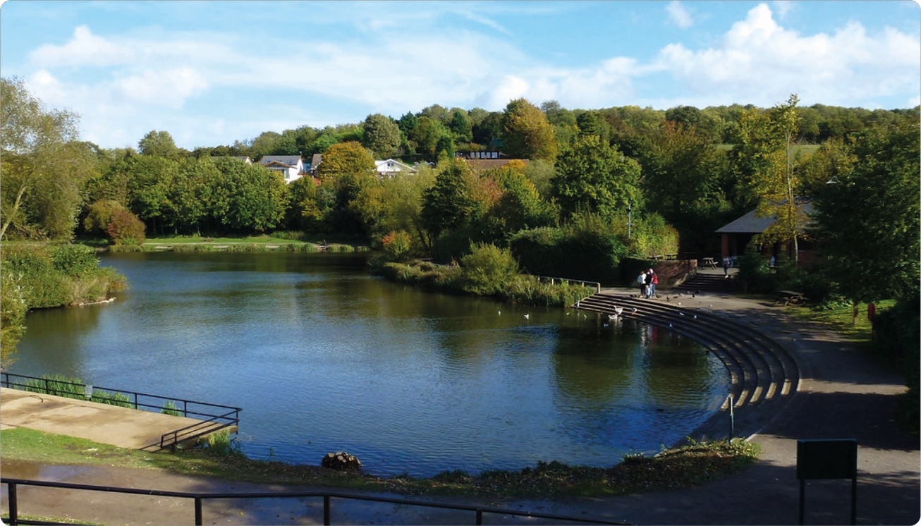
3.2.12. With regards to formal open spaces these are generally provided to the north of the site. Lordswood Leisure Centre provides formal pitch provision and gym space, and Capstone Country Park provides opportunities for walking, fishing and children's play. To the south of the site there are limited formal open spaces with only some allotment provision in Bredhurst Village.
Views
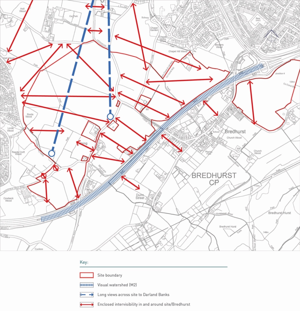
3.2.13. Studies also indicated that the site is self-contained with regards to views into and across the site from outside as demonstrated in Figure 15. However, within the site there are long distance view across the site.
Heritage & Archaeology
3.2.14. The Maidstone Heritage Impact Assessment (2021) and Lidsing Archaeology & Cultural Heritage Scoping Report (2021) were prepared to inform the preparation of the Local Plan Review. Development proposals should have regard to and build upon this technical evidence to ensure a comprehensive understanding of and response to the local historic environment.
3.2.15. Desk based heritage assessments have been undertaken and these have concluded that there are no designated heritage assets (built or archaeological) within the site. This means there are no World Heritage Sites, Registered Battlefields, Registered Parks and Gardens, Historic Wreck sites, listed buildings or conservation areas. However, there are archaeological assets close to the site and further work is essential to establish the presence or absence of significant archaeological assets. Within the village of Bredhurst there are several designated heritage assets.
These include:
- Green Court Listed Building (II).
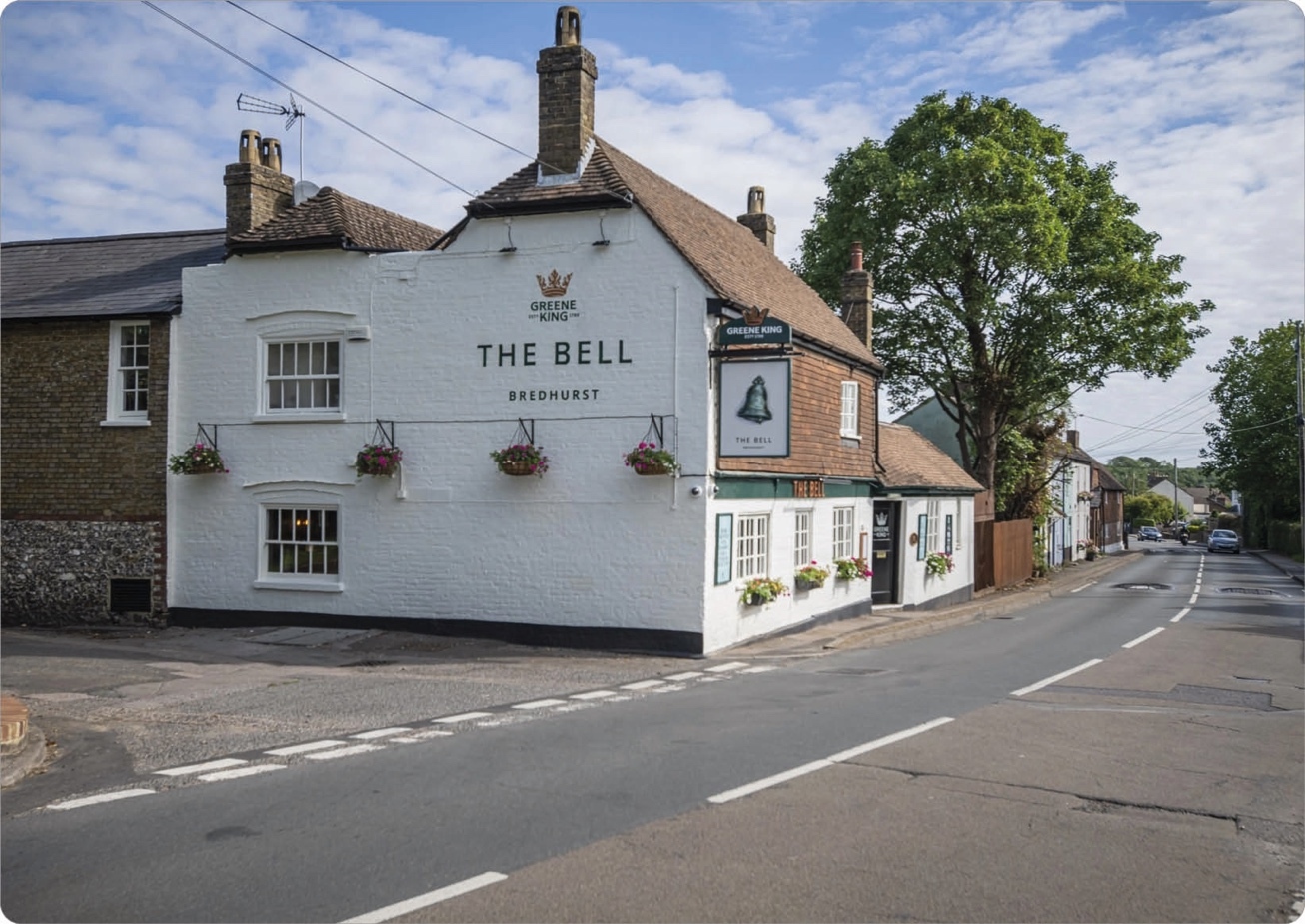
- The Bell Public House, Bredhurst Listed Building (II.)
- Hollyhock Cottage, Listed Building (II).
- Horseshoes, Bredhurst, Listed Building (II).
- Abbotts Court House, Listed Building (II) - 1186019.
- Kemsley Street Farmhouse, Listed Building (II).
- The Church of St Peter, Bredhurst, Listed Building (II). Also listed are several late seventeenth-early eighteenth century table tombs associated with the church.
3.2.16. As part of the evidence base for the SPD further heritage studies have been undertaken to review the potential impacts of the development on both built heritage and archaeology in the area. Whilst the Desk Based Assessments have not identified any heritage assets, there is potential for below ground archaeology and this should be assessed further prior to any planning permission.
Movement & Connectivity
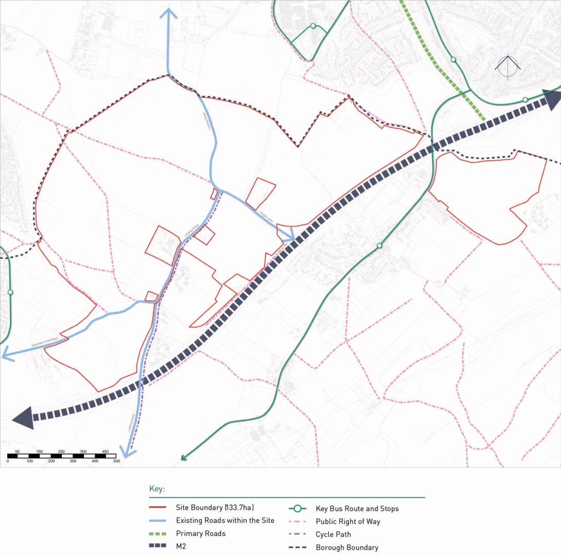
3.2.17. Figure 17 identifies the current routes and connectivity of Lidsing, identifying existing vehicular routes and access. The existing bus network is generally confined to the existing built areas of Lordswood and Hempstead, with no 'east-west' connectivity through the Capstone Valley.
3.2.18. The Strategic Road Network managed by National Highways is adjacent to the site. The M2 motorway runs south of the site area (with the exception of c. 20ha of land located within the National Landscape south of the M2). Junction 4 of the M2 is a three-arm junction that has the potential for an additional access arm to the south. This junction is a key arrival point for the Medway towns and particularly the Hempstead area.
3.2.19. Junction 3 of the M2 is located west of Lidsing and with a closer functional relationship with areas of Lordswood. This junction experiences more significant traffic flow and peak congestion and is a key route to the Medway towns and a main link south to Maidstone.
3.2.20. North Dane Way lies to the west of the Lidsing Garden Community site and the Medway Southern Peripheral Route was historically planned to connect this road with the M2 but was never implemented and the road terminates within Lordswood.
3.2.21. The site has various existing active travel routes that run through it. These include several Public Rights of Way; Byway 0037/KH41/1, Restricted Byway 0037/KH37/1, and footpaths KH34, KH35 and KH634. No National Cycle Routes run through or near to the site.
3.2.22. With regards to public transport there are presently no bus stops within the site. The nearest ones being in Bredhurst (south), Gleaming Wood Drive (west), and Hempstead Valley Shopping Centre (east). No bus routes presently stop in the site, but there are several located within the vicinity of the site.


Local Services
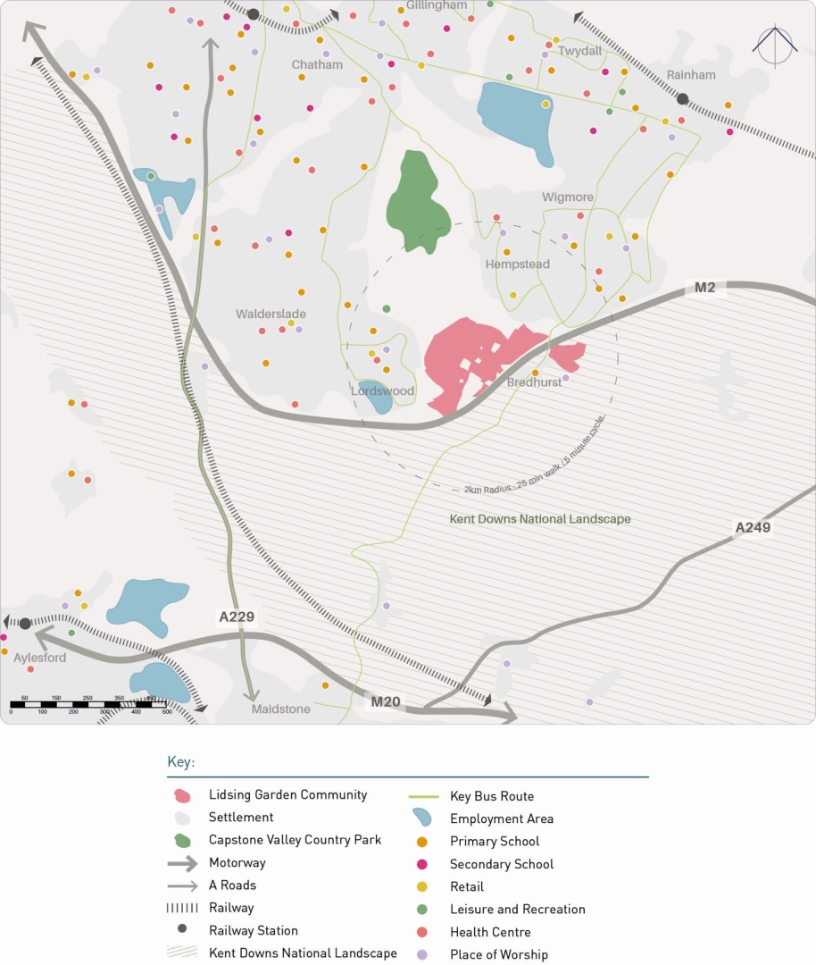
3.2.23. The new garden community of Lidsing is positioned between the Lordswood urban area (to the west) the Hempstead urban area (to the east) and the recreational hub of the Capstone Country Park to the north and the village of Bredhurst to the south with the village of Boxley further to the south.
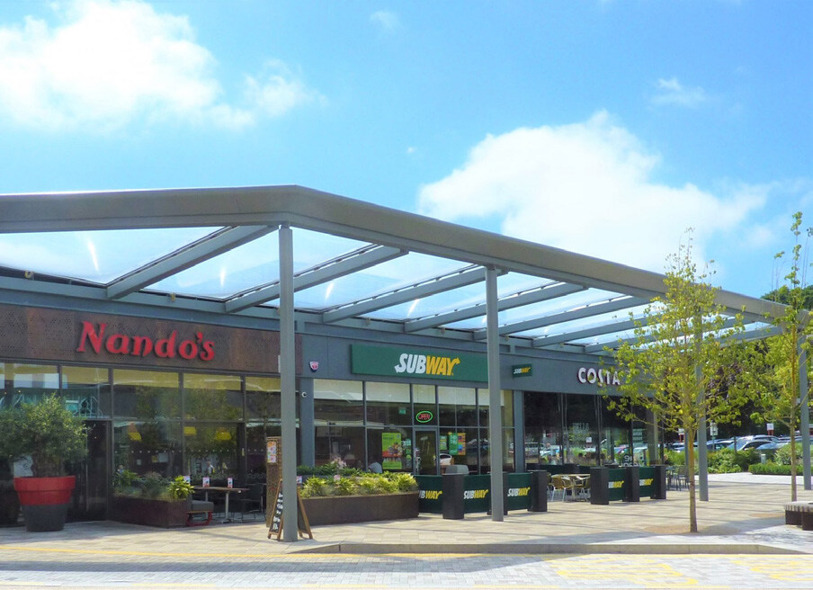
3.2.24. The majority of existing services are located within the Medway authority area. For retail the closest assets are Hempstead Valley Shopping Centre to the northeast and Lordswood Local Centre to the west. For healthcare the nearest medical facilities are in Lordswood and Hempstead.
3.2.25. There are existing employment areas to the north at Elm Court and Gillingham Business Park further to the north.
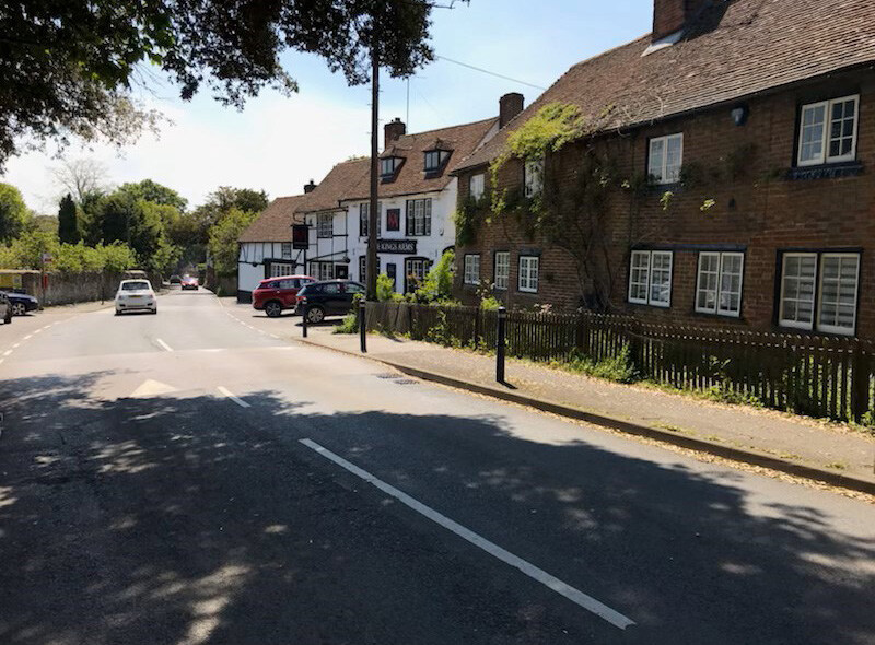
3.2.26. The village of Bredhurst to the south does have several local services such as the Bell Pub, a primary school, a church, a village hall and motor repair garage.
3.3. Opportunities & Constraints
Taking all the information outlined in the above sections and building on the earlier site allocation process. This has helped to identify the principal constraints and opportunities of the site, which have in turn informed the development of the masterplan.
Opportunities
3.3.1. Key opportunities on site identified are:
- The site will deliver east – west connectivity across the Capstone Valley.
- A new local centre and associated social infrastructure is to be provided on site.
- Improve access to the M2 Junction 4.
- Access to the Kent Downs National Landscape for new residents.
- Opportunity for a strategic employment site.
- There is very limited impact on designated heritage assets on or near to the site, though the potential for archaeology.
- There is the opportunity to link the habitats and increase the biodiversity of the site.
Constraints
3.3.2. Key constraints on site identified are:
- Part of the site lies within the Kent Downs National Landscape and its' setting.
- There are pockets of Ancient Woodland in and adjacent to the site.
- The site has pockets of third party owned land within it.
- There are areas of ecological value and habitat on the site.
- There are areas of surface water flood risk.
- There are existing public rights of way running through the site.
- Potential for archaeology.
- Setting of listed building within Bredhurst, particularly where the new link to the motorway is to be formed.
Q1: Do you agree with the principle of introducing additional planning guidance for the Lidsing Garden Settlement in the form of a Supplementary Planning Document? View representations
Q2: Do you agree that the correct key issues and elements have been identified in relation to the context of the site? View representations
Q3: Are there any issues and elements which you feel are inaccurate or missing? View representations